A Data-Driven Analytical Framework of Estimating Multimodal Travel Demand Patterns using Mobile Device Location Data
Paper and Code
Dec 08, 2020


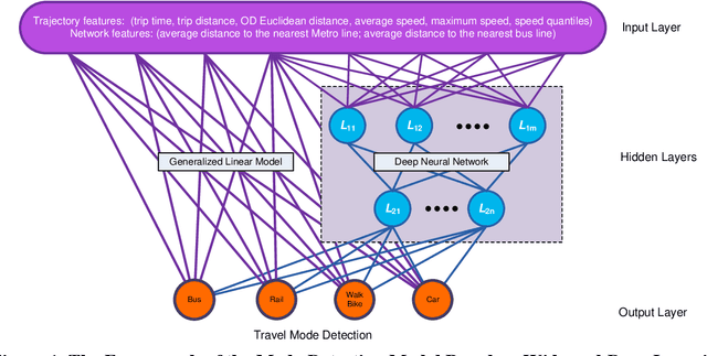
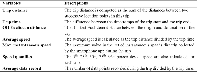
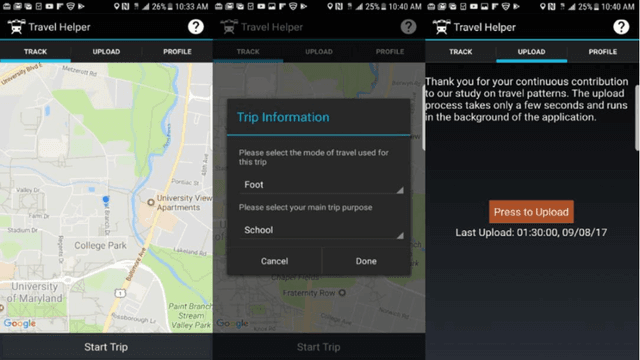
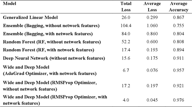
While benefiting people's daily life in so many ways, smartphones and their location-based services are generating massive mobile device location data that has great potential to help us understand travel demand patterns and make transportation planning for the future. While recent studies have analyzed human travel behavior using such new data sources, limited research has been done to extract multimodal travel demand patterns out of them. This paper presents a data-driven analytical framework to bridge the gap. To be able to successfully detect travel modes using the passively collected location information, we conduct a smartphone-based GPS survey to collect ground truth observations. Then a jointly trained single-layer model and deep neural network for travel mode imputation is developed. Being "wide" and "deep" at the same time, this model combines the advantages of both types of models. The framework also incorporates the multimodal transportation network in order to evaluate the closeness of trip routes to the nearby rail, metro, highway and bus lines and therefore enhance the imputation accuracy. To showcase the applications of the introduced framework in answering real-world planning needs, a separate mobile device location data is processed through trip end identification and attribute generation, in a way that the travel mode imputation can be directly applied. The estimated multimodal travel demand patterns are then validated against typical household travel surveys in the same Washington D.C. and Baltimore Metropolitan Regions.
 Add to Chrome
 Add to Firefox
 Add to Edge