Santiago Belda
Fusing Optical and SAR time series for LAI gap filling with multioutput Gaussian processes
Dec 05, 2020


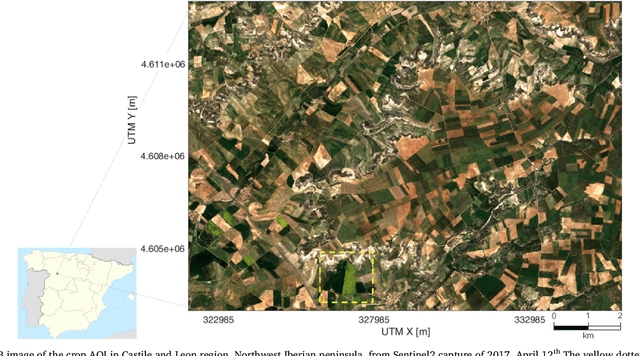
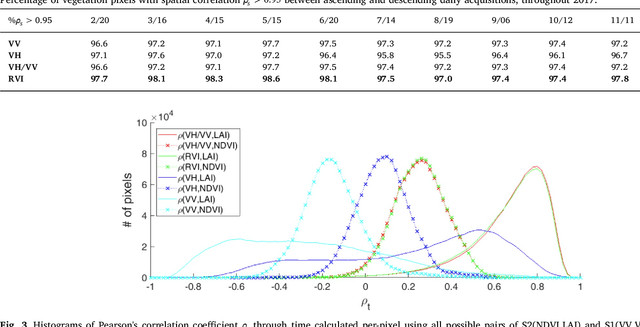
Abstract:The availability of satellite optical information is often hampered by the natural presence of clouds, which can be problematic for many applications. Persistent clouds over agricultural fields can mask key stages of crop growth, leading to unreliable yield predictions. Synthetic Aperture Radar (SAR) provides all-weather imagery which can potentially overcome this limitation, but given its high and distinct sensitivity to different surface properties, the fusion of SAR and optical data still remains an open challenge. In this work, we propose the use of Multi-Output Gaussian Process (MOGP) regression, a machine learning technique that learns automatically the statistical relationships among multisensor time series, to detect vegetated areas over which the synergy between SAR-optical imageries is profitable. For this purpose, we use the Sentinel-1 Radar Vegetation Index (RVI) and Sentinel-2 Leaf Area Index (LAI) time series over a study area in north west of the Iberian peninsula. Through a physical interpretation of MOGP trained models, we show its ability to provide estimations of LAI even over cloudy periods using the information shared with RVI, which guarantees the solution keeps always tied to real measurements. Results demonstrate the advantage of MOGP especially for long data gaps, where optical-based methods notoriously fail. The leave-one-image-out assessment technique applied to the whole vegetation cover shows MOGP predictions improve standard GP estimations over short-time gaps (R$^2$ of 74\% vs 68\%, RMSE of 0.4 vs 0.44 $[m^2m^{-2}]$) and especially over long-time gaps (R$^2$ of 33\% vs 12\%, RMSE of 0.5 vs 1.09 $[m^2m^{-2}]$).
* 43 pages, 12 figures
 Add to Chrome
 Add to Firefox
 Add to Edge