Sébastien Clerc
DAugNet: Unsupervised, Multi-source, Multi-target, and Life-long Domain Adaptation for Semantic Segmentation of Satellite Images
Jun 07, 2020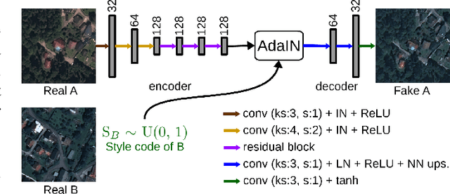
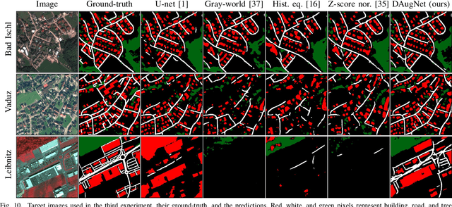

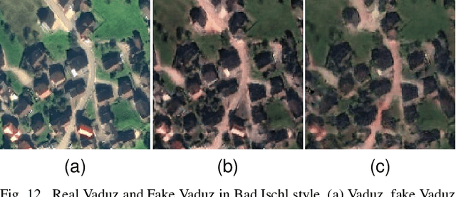
Abstract:The domain adaptation of satellite images has recently gained an increasing attention to overcome the limited generalization abilities of machine learning models when segmenting large-scale satellite images. Most of the existing approaches seek for adapting the model from one domain to another. However, such single-source and single-target setting prevents the methods from being scalable solutions, since nowadays multiple source and target domains having different data distributions are usually available. Besides, the continuous proliferation of satellite images necessitates the classifiers to adapt to continuously increasing data. We propose a novel approach, coined DAugNet, for unsupervised, multi-source, multi-target, and life-long domain adaptation of satellite images. It consists of a classifier and a data augmentor. The data augmentor, which is a shallow network, is able to perform style transfer between multiple satellite images in an unsupervised manner, even when new data are added over the time. In each training iteration, it provides the classifier with diversified data, which makes the classifier robust to large data distribution difference between the domains. Our extensive experiments prove that DAugNet significantly better generalizes to new geographic locations than the existing approaches.
StandardGAN: Multi-source Domain Adaptation for Semantic Segmentation of Very High Resolution Satellite Images by Data Standardization
Apr 14, 2020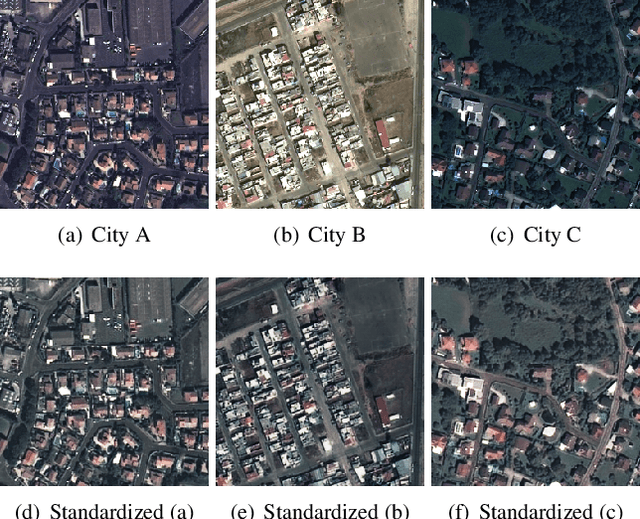
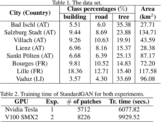
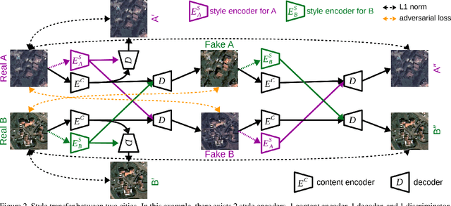
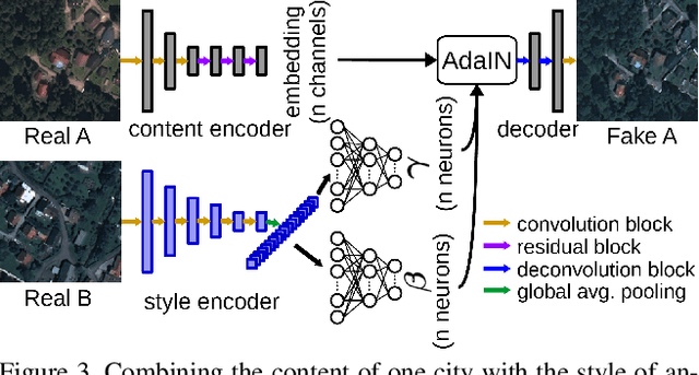
Abstract:Domain adaptation for semantic segmentation has recently been actively studied to increase the generalization capabilities of deep learning models. The vast majority of the domain adaptation methods tackle single-source case, where the model trained on a single source domain is adapted to a target domain. However, these methods have limited practical real world applications, since usually one has multiple source domains with different data distributions. In this work, we deal with the multi-source domain adaptation problem. Our method, namely StandardGAN, standardizes each source and target domains so that all the data have similar data distributions. We then use the standardized source domains to train a classifier and segment the standardized target domain. We conduct extensive experiments on two remote sensing data sets, in which the first one consists of multiple cities from a single country, and the other one contains multiple cities from different countries. Our experimental results show that the standardized data generated by StandardGAN allow the classifiers to generate significantly better segmentation.
 Add to Chrome
 Add to Firefox
 Add to Edge