Nikola Marković
Estimating Historical Hourly Traffic Volumes via Machine Learning and Vehicle Probe Data: A Maryland Case Study
Oct 17, 2018


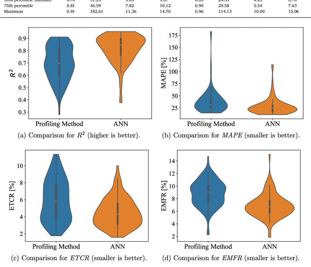
Abstract:This paper focuses on the problem of estimating historical traffic volumes between sparsely-located traffic sensors, which transportation agencies need to accurately compute statewide performance measures. To this end, the paper examines applications of vehicle probe data, automatic traffic recorder counts, and neural network models to estimate hourly volumes in the Maryland highway network, and proposes a novel approach that combines neural networks with an existing profiling method. On average, the proposed approach yields 24% more accurate estimates than volume profiles, which are currently used by transportation agencies across the US to compute statewide performance measures. The paper also quantifies the value of using vehicle probe data in estimating hourly traffic volumes, which provides important managerial insights to transportation agencies interested in acquiring this type of data. For example, results show that volumes can be estimated with a mean absolute percent error of about 21% at locations where average number of observed probes is between 30 and 47 vehicles/hr, which provides a useful guideline for assessing the value of probe vehicle data from different vendors.
Applications of Trajectory Data from the Perspective of a Road Transportation Agency: Literature Review and Maryland Case Study
May 30, 2018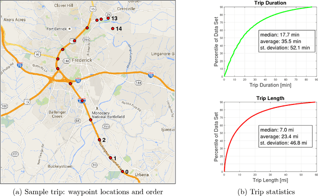
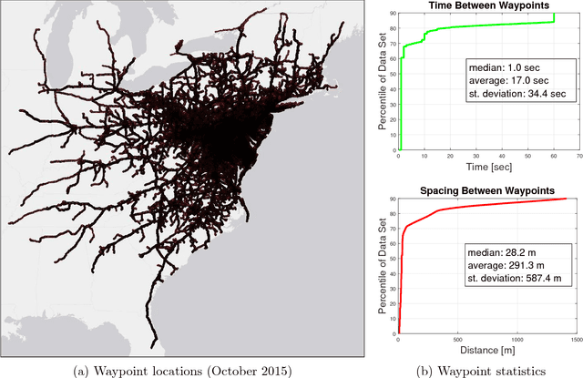
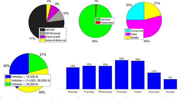
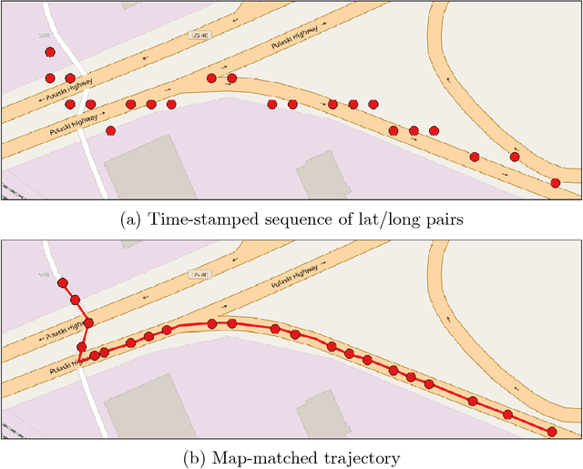
Abstract:Transportation agencies have an opportunity to leverage increasingly-available trajectory datasets to improve their analyses and decision-making processes. However, this data is typically purchased from vendors, which means agencies must understand its potential benefits beforehand in order to properly assess its value relative to the cost of acquisition. While the literature concerned with trajectory data is rich, it is naturally fragmented and focused on technical contributions in niche areas, which makes it difficult for government agencies to assess its value across different transportation domains. To overcome this issue, the current paper explores trajectory data from the perspective of a road transportation agency interested in acquiring trajectories to enhance its analyses. The paper provides a literature review illustrating applications of trajectory data in six areas of road transportation systems analysis: demand estimation, modeling human behavior, designing public transit, traffic performance measurement and prediction, environment and safety. In addition, it visually explores 20 million GPS traces in Maryland, illustrating existing and suggesting new applications of trajectory data.
 Add to Chrome
 Add to Firefox
 Add to Edge