Marta C. Gonzalez
Where to Go Next Day: Multi-scale Spatial-Temporal Decoupled Model for Mid-term Human Mobility Prediction
Jan 11, 2025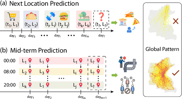

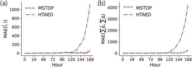
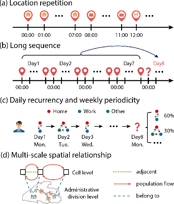
Abstract:Predicting individual mobility patterns is crucial across various applications. While current methods mainly focus on predicting the next location for personalized services like recommendations, they often fall short in supporting broader applications such as traffic management and epidemic control, which require longer period forecasts of human mobility. This study addresses mid-term mobility prediction, aiming to capture daily travel patterns and forecast trajectories for the upcoming day or week. We propose a novel Multi-scale Spatial-Temporal Decoupled Predictor (MSTDP) designed to efficiently extract spatial and temporal information by decoupling daily trajectories into distinct location-duration chains. Our approach employs a hierarchical encoder to model multi-scale temporal patterns, including daily recurrence and weekly periodicity, and utilizes a transformer-based decoder to globally attend to predicted information in the location or duration chain. Additionally, we introduce a spatial heterogeneous graph learner to capture multi-scale spatial relationships, enhancing semantic-rich representations. Extensive experiments, including statistical physics analysis, are conducted on large-scale mobile phone records in five cities (Boston, Los Angeles, SF Bay Area, Shanghai, and Tokyo), to demonstrate MSTDP's advantages. Applied to epidemic modeling in Boston, MSTDP significantly outperforms the best-performing baseline, achieving a remarkable 62.8% reduction in MAE for cumulative new cases.
Inferring land use from mobile phone activity
Jul 03, 2012

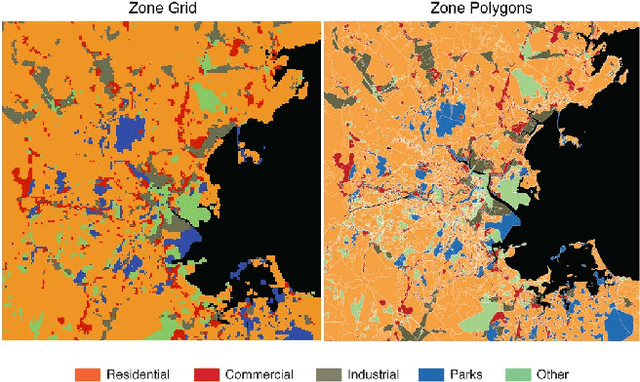
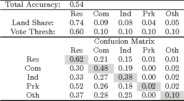
Abstract:Understanding the spatiotemporal distribution of people within a city is crucial to many planning applications. Obtaining data to create required knowledge, currently involves costly survey methods. At the same time ubiquitous mobile sensors from personal GPS devices to mobile phones are collecting massive amounts of data on urban systems. The locations, communications, and activities of millions of people are recorded and stored by new information technologies. This work utilizes novel dynamic data, generated by mobile phone users, to measure spatiotemporal changes in population. In the process, we identify the relationship between land use and dynamic population over the course of a typical week. A machine learning classification algorithm is used to identify clusters of locations with similar zoned uses and mobile phone activity patterns. It is shown that the mobile phone data is capable of delivering useful information on actual land use that supplements zoning regulations.
 Add to Chrome
 Add to Firefox
 Add to Edge