Marcos Antonio Vaz Salles
CLIP-Branches: Interactive Fine-Tuning for Text-Image Retrieval
Jun 19, 2024


Abstract:The advent of text-image models, most notably CLIP, has significantly transformed the landscape of information retrieval. These models enable the fusion of various modalities, such as text and images. One significant outcome of CLIP is its capability to allow users to search for images using text as a query, as well as vice versa. This is achieved via a joint embedding of images and text data that can, for instance, be used to search for similar items. Despite efficient query processing techniques such as approximate nearest neighbor search, the results may lack precision and completeness. We introduce CLIP-Branches, a novel text-image search engine built upon the CLIP architecture. Our approach enhances traditional text-image search engines by incorporating an interactive fine-tuning phase, which allows the user to further concretize the search query by iteratively defining positive and negative examples. Our framework involves training a classification model given the additional user feedback and essentially outputs all positively classified instances of the entire data catalog. By building upon recent techniques, this inference phase, however, is not implemented by scanning the entire data catalog, but by employing efficient index structures pre-built for the data. Our results show that the fine-tuned results can improve the initial search outputs in terms of relevance and accuracy while maintaining swift response times
Detecting Hardly Visible Roads in Low-Resolution Satellite Time Series Data
Dec 04, 2019


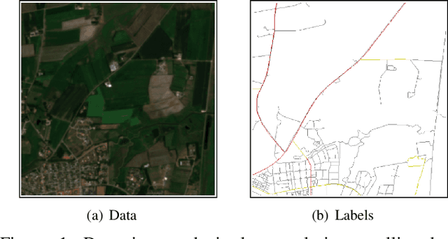
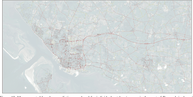
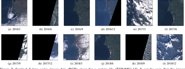
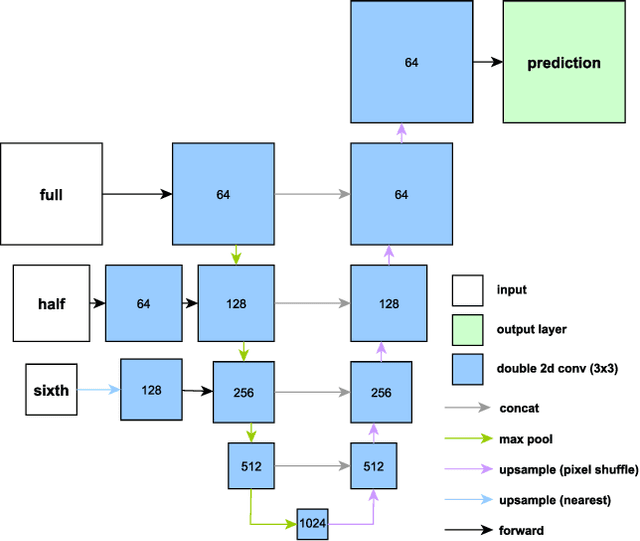
Abstract:Massive amounts of satellite data have been gathered over time, holding the potential to unveil a spatiotemporal chronicle of the surface of Earth. These data allow scientists to investigate various important issues, such as land use changes, on a global scale. However, not all land-use phenomena are equally visible on satellite imagery. In particular, the creation of an inventory of the planet's road infrastructure remains a challenge, despite being crucial to analyze urbanization patterns and their impact. Towards this end, this work advances data-driven approaches for the automatic identification of roads based on open satellite data. Given the typical resolutions of these historical satellite data, we observe that there is inherent variation in the visibility of different road types. Based on this observation, we propose two deep learning frameworks that extend state-of-the-art deep learning methods by formalizing road detection as an ordinal classification task. In contrast to related schemes, one of the two models also resorts to satellite time series data that are potentially affected by missing data and cloud occlusion. Taking these time series data into account eliminates the need to manually curate datasets of high-quality image tiles, substantially simplifying the application of such models on a global scale. We evaluate our approaches on a dataset that is based on Sentinel~2 satellite imagery and OpenStreetMap vector data. Our results indicate that the proposed models can successfully identify large and medium-sized roads. We also discuss opportunities and challenges related to the detection of roads and other infrastructure on a global scale.
 Add to Chrome
 Add to Firefox
 Add to Edge