Jean Remy Kubwimana
Modelling spatio-temporal trends of air pollution in Africa
Aug 21, 2022
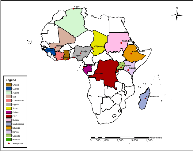
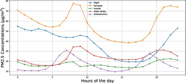
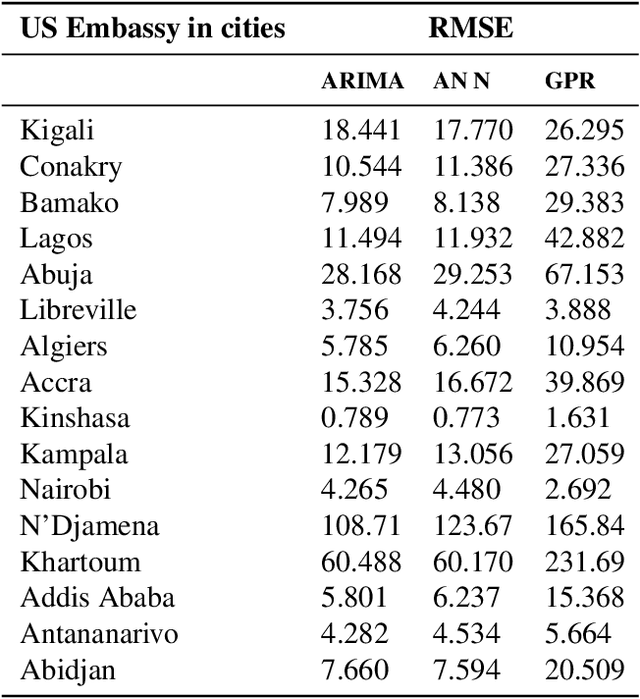
Abstract:Atmospheric pollution remains one of the major public health threat worldwide with an estimated 7 millions deaths annually. In Africa, rapid urbanization and poor transport infrastructure are worsening the problem. In this paper, we have analysed spatio-temporal variations of PM2.5 across different geographical regions in Africa. The West African region remains the most affected by the high levels of pollution with a daily average of 40.856 $\mu g/m^3$ in some cities like Lagos, Abuja and Bamako. In East Africa, Uganda is reporting the highest pollution level with a daily average concentration of 56.14 $\mu g/m^3$ and 38.65 $\mu g/m^3$ for Kigali. In countries located in the central region of Africa, the highest daily average concentration of PM2.5 of 90.075 $\mu g/m^3$ was recorded in N'Djamena. We compare three data driven models in predicting future trends of pollution levels. Neural network is outperforming Gaussian processes and ARIMA models.
Trend analysis and forecasting air pollution in Rwanda
May 20, 2022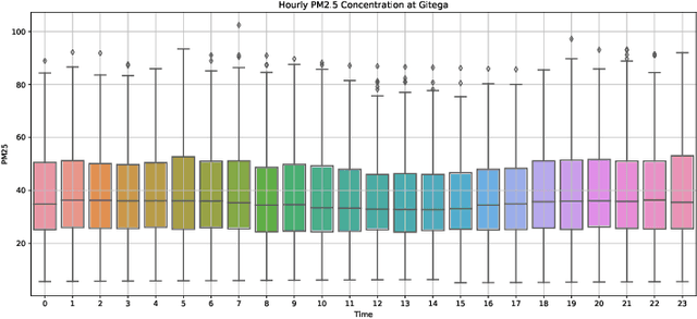
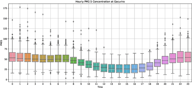


Abstract:Air pollution is a major public health problem worldwide although the lack of data is a global issue for most low and middle income countries. Ambient air pollution in the form of fine particulate matter (PM2.5) exceeds the World Health Organization guidelines in Rwanda with a daily average of around 42.6 microgram per meter cube. Monitoring and mitigation strategies require an expensive investment in equipment to collect pollution data. Low-cost sensor technology and machine learning methods have appeared as an alternative solution to get reliable information for decision making. This paper analyzes the trend of air pollution in Rwanda and proposes forecasting models suitable to data collected by a network of low-cost sensors deployed in Rwanda.
 Add to Chrome
 Add to Firefox
 Add to Edge