 Add to Chrome
 Add to Firefox
 Add to Edge
Aerial Imagery based LIDAR Localization for Autonomous Vehicles
Mar 25, 2020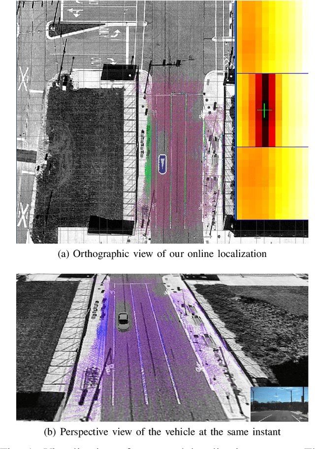
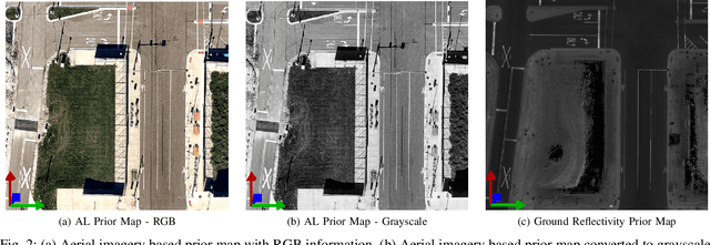
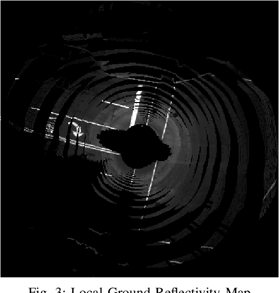

This paper presents a localization technique using aerial imagery maps and LIDAR based ground reflectivity for autonomous vehicles in urban environments. Traditional localization techniques using LIDAR reflectivity rely on high definition reflectivity maps generated from a mapping vehicle. The cost and effort required to maintain such prior maps are generally very high because it requires a fleet of expensive mapping vehicles. In this work we propose a localization technique where the vehicle localizes using aerial/satellite imagery, eradicating the need to develop and maintain complex high-definition maps. The proposed technique has been tested on a real world dataset collected from a test track in Ann Arbor, Michigan. This research concludes that aerial imagery based maps provides real-time localization performance similar to state-of-the-art LIDAR based maps for autonomous vehicles in urban environments at reduced costs.
Ford Multi-AV Seasonal Dataset
Mar 17, 2020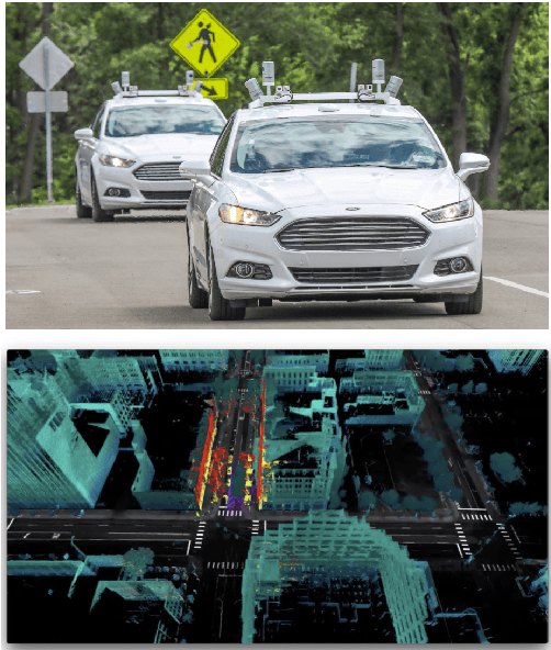


This paper presents a challenging multi-agent seasonal dataset collected by a fleet of Ford autonomous vehicles at different days and times during 2017-18. The vehicles traversed an average route of 66 km in Michigan that included a mix of driving scenarios such as the Detroit Airport, freeways, city-centers, university campus and suburban neighbourhoods, etc. Each vehicle used in this data collection is a Ford Fusion outfitted with an Applanix POS-LV GNSS system, four HDL-32E Velodyne 3D-lidar scanners, 6 Point Grey 1.3 MP Cameras arranged on the rooftop for 360-degree coverage and 1 Pointgrey 5 MP camera mounted behind the windshield for the forward field of view. We present the seasonal variation in weather, lighting, construction and traffic conditions experienced in dynamic urban environments. This dataset can help design robust algorithms for autonomous vehicles and multi-agent systems. Each log in the dataset is time-stamped and contains raw data from all the sensors, calibration values, pose trajectory, ground truth pose, and 3D maps. All data is available in Rosbag format that can be visualized, modified and applied using the open-source Robot Operating System (ROS). We also provide the output of state-of-the-art reflectivity-based localization for bench-marking purposes. The dataset can be freely downloaded at our website.