Geoffrey C Fox
Multi-Task Spatiotemporal Neural Networks for Structured Surface Reconstruction
Jul 20, 2018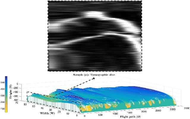

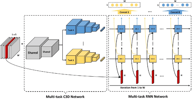
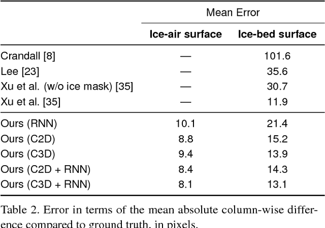
Abstract:Deep learning methods have surpassed the performance of traditional techniques on a wide range of problems in computer vision, but nearly all of this work has studied consumer photos, where precisely correct output is often not critical. It is less clear how well these techniques may apply on structured prediction problems where fine-grained output with high precision is required, such as in scientific imaging domains. Here we consider the problem of segmenting echogram radar data collected from the polar ice sheets, which is challenging because segmentation boundaries are often very weak and there is a high degree of noise. We propose a multi-task spatiotemporal neural network that combines 3D ConvNets and Recurrent Neural Networks (RNNs) to estimate ice surface boundaries from sequences of tomographic radar images. We show that our model outperforms the state-of-the-art on this problem by (1) avoiding the need for hand-tuned parameters, (2) extracting multiple surfaces (ice-air and ice-bed) simultaneously, (3) requiring less non-visual metadata, and (4) being about 6 times faster.
Automatic Estimation of Ice Bottom Surfaces from Radar Imagery
Dec 21, 2017
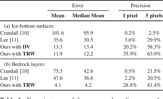
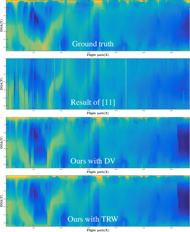
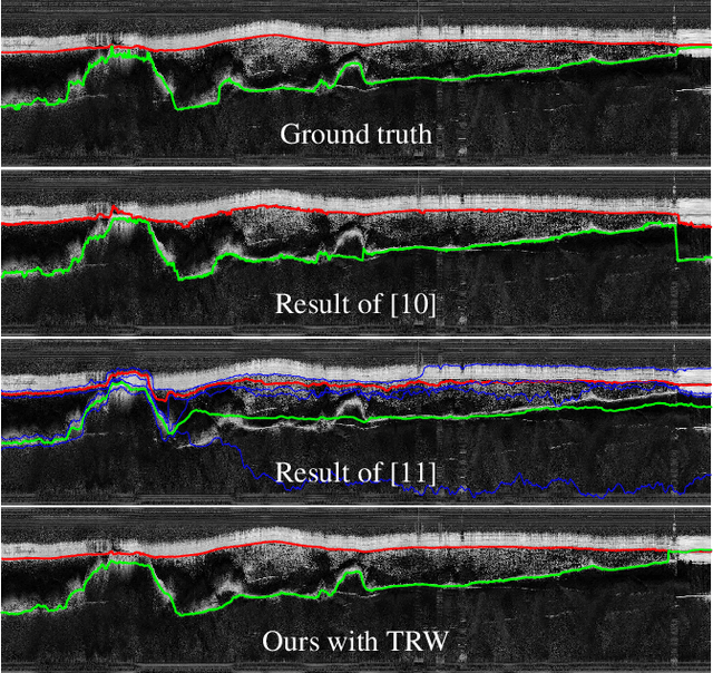
Abstract:Ground-penetrating radar on planes and satellites now makes it practical to collect 3D observations of the subsurface structure of the polar ice sheets, providing crucial data for understanding and tracking global climate change. But converting these noisy readings into useful observations is generally done by hand, which is impractical at a continental scale. In this paper, we propose a computer vision-based technique for extracting 3D ice-bottom surfaces by viewing the task as an inference problem on a probabilistic graphical model. We first generate a seed surface subject to a set of constraints, and then incorporate additional sources of evidence to refine it via discrete energy minimization. We evaluate the performance of the tracking algorithm on 7 topographic sequences (each with over 3000 radar images) collected from the Canadian Arctic Archipelago with respect to human-labeled ground truth.
 Add to Chrome
 Add to Firefox
 Add to Edge