Emanuela Clementi
Deep Learning for Sea Surface Temperature Reconstruction under Cloud Occlusion
Dec 04, 2024Abstract:Sea Surface Temperature (SST) is crucial for understanding Earth's oceans and climate, significantly influencing weather patterns, ocean currents, marine ecosystem health, and the global energy balance. Large-scale SST monitoring relies on satellite infrared radiation detection, but cloud cover presents a major challenge, creating extensive observational gaps and hampering our ability to fully capture large-scale ocean temperature patterns. Efforts to address these gaps in existing L4 datasets have been made, but they often exhibit notable local and seasonal biases, compromising data reliability and accuracy. To tackle this challenge, we employed deep neural networks to reconstruct cloud-covered portions of satellite imagery while preserving the integrity of observed values in cloud-free areas, using MODIS satellite derived observations of SST. Our best-performing architecture showed significant skill improvements over established methodologies, achieving substantial reductions in error metrics when benchmarked against widely used approaches and datasets. These results underscore the potential of advanced AI techniques to enhance the completeness of satellite observations in Earth-science remote sensing, providing more accurate and reliable datasets for environmental assessments, data-driven model training, climate research, and seamless integration into model data assimilation workflows.
Regional Ocean Forecasting with Hierarchical Graph Neural Networks
Oct 15, 2024


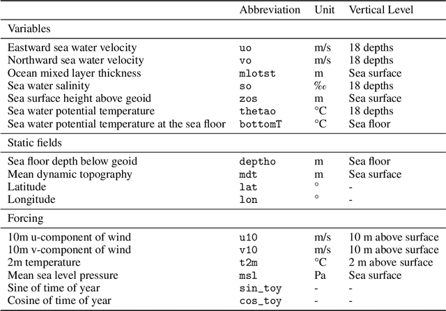
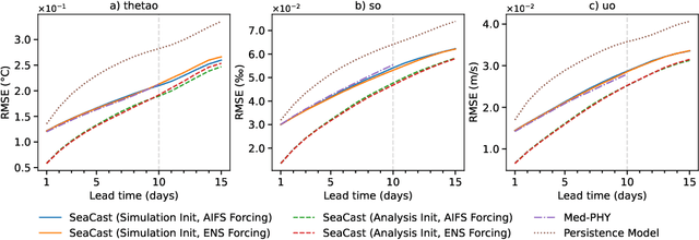
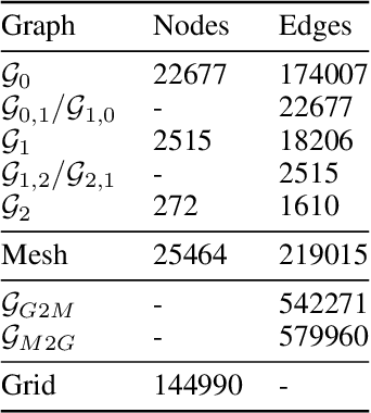
Abstract:Accurate ocean forecasting systems are vital for understanding marine dynamics, which play a crucial role in environmental management and climate adaptation strategies. Traditional numerical solvers, while effective, are computationally expensive and time-consuming. Recent advancements in machine learning have revolutionized weather forecasting, offering fast and energy-efficient alternatives. Building on these advancements, we introduce SeaCast, a neural network designed for high-resolution, medium-range ocean forecasting. SeaCast employs a graph-based framework to effectively handle the complex geometry of ocean grids and integrates external forcing data tailored to the regional ocean context. Our approach is validated through experiments at a high spatial resolution using the operational numerical model of the Mediterranean Sea provided by the Copernicus Marine Service, along with both numerical and data-driven atmospheric forcings.
 Add to Chrome
 Add to Firefox
 Add to Edge