Chirag Padubidri
GAEA: Experiences and Lessons Learned from a Country-Scale Environmental Digital Twin
Nov 17, 2025Abstract:This paper describes the experiences and lessons learned after the deployment of a country-scale environmental digital twin on the island of Cyprus for three years. This digital twin, called GAEA, contains 27 environmental geospatial services and is suitable for urban planners, policymakers, farmers, property owners, real-estate and forestry professionals, as well as insurance companies and banks that have properties in their portfolio. This paper demonstrates the power, potential, current and future challenges of geospatial analytics and environmental digital twins on a large scale.
FrogDeepSDM: Improving Frog Counting and Occurrence Prediction Using Multimodal Data and Pseudo-Absence Imputation
Oct 22, 2025Abstract:Monitoring species distribution is vital for conservation efforts, enabling the assessment of environmental impacts and the development of effective preservation strategies. Traditional data collection methods, including citizen science, offer valuable insights but remain limited in coverage and completeness. Species Distribution Modelling (SDM) helps address these gaps by using occurrence data and environmental variables to predict species presence across large regions. In this study, we enhance SDM accuracy for frogs (Anura) by applying deep learning and data imputation techniques using data from the "EY - 2022 Biodiversity Challenge." Our experiments show that data balancing significantly improved model performance, reducing the Mean Absolute Error (MAE) from 189 to 29 in frog counting tasks. Feature selection identified key environmental factors influencing occurrence, optimizing inputs while maintaining predictive accuracy. The multimodal ensemble model, integrating land cover, NDVI, and other environmental inputs, outperformed individual models and showed robust generalization across unseen regions. The fusion of image and tabular data improved both frog counting and habitat classification, achieving 84.9% accuracy with an AUC of 0.90. This study highlights the potential of multimodal learning and data preprocessing techniques such as balancing and imputation to improve predictive ecological modeling when data are sparse or incomplete, contributing to more precise and scalable biodiversity monitoring.
Exploiting Digital Surface Models for Inferring Super-Resolution for Remotely Sensed Images
May 09, 2022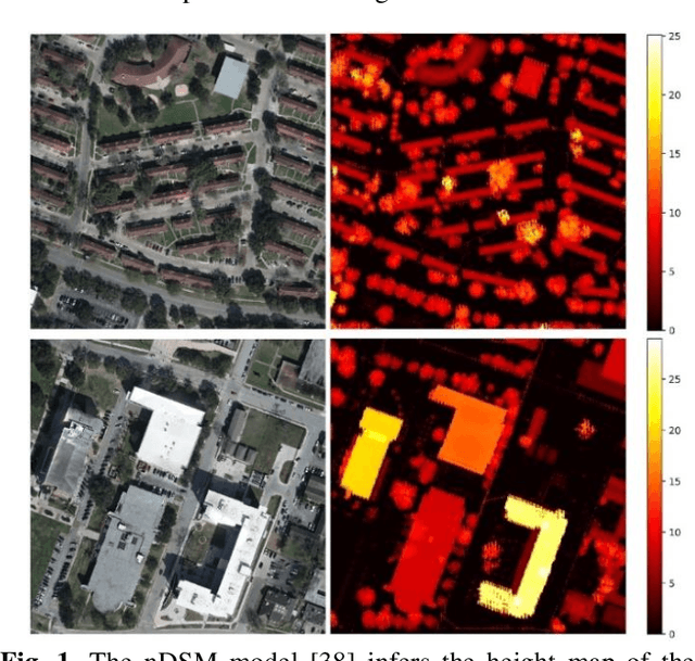


Abstract:Despite the plethora of successful Super-Resolution Reconstruction (SRR) models applied to natural images, their application to remote sensing imagery tends to produce poor results. Remote sensing imagery is often more complicated than natural images and has its peculiarities such as being of lower resolution, it contains noise, and often depicting large textured surfaces. As a result, applying non-specialized SRR models on remote sensing imagery results in artifacts and poor reconstructions. To address these problems, this paper proposes an architecture inspired by previous research work, introducing a novel approach for forcing an SRR model to output realistic remote sensing images: instead of relying on feature-space similarities as a perceptual loss, the model considers pixel-level information inferred from the normalized Digital Surface Model (nDSM) of the image. This strategy allows the application of better-informed updates during the training of the model which sources from a task (elevation map inference) that is closely related to remote sensing. Nonetheless, the nDSM auxiliary information is not required during production and thus the model infers a super-resolution image without any additional data besides its low-resolution pairs. We assess our model on two remotely sensed datasets of different spatial resolutions that also contain the DSM pairs of the images: the DFC2018 dataset and the dataset containing the national Lidar fly-by of Luxembourg. Based on visual inspection, the inferred super-resolution images exhibit particularly superior quality. In particular, the results for the high-resolution DFC2018 dataset are realistic and almost indistinguishable from the ground truth images.
EscapeWildFire: Assisting People to Escape Wildfires in Real-Time
Feb 23, 2021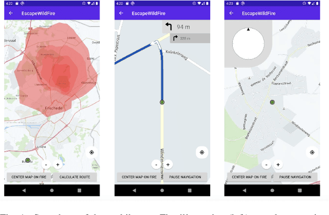
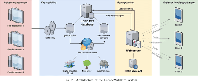
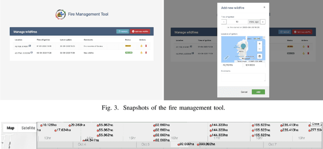
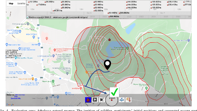
Abstract:Over the past couple of decades, the number of wildfires and area of land burned around the world has been steadily increasing, partly due to climatic changes and global warming. Therefore, there is a high probability that more people will be exposed to and endangered by forest fires. Hence there is an urgent need to design pervasive systems that effectively assist people and guide them to safety during wildfires. This paper presents EscapeWildFire, a mobile application connected to a backend system which models and predicts wildfire geographical progression, assisting citizens to escape wildfires in real-time. A small pilot indicates the correctness of the system. The code is open-source; fire authorities around the world are encouraged to adopt this approach.
 Add to Chrome
 Add to Firefox
 Add to Edge