Boris Wattrelos
FLAIR: a Country-Scale Land Cover Semantic Segmentation Dataset From Multi-Source Optical Imagery
Oct 20, 2023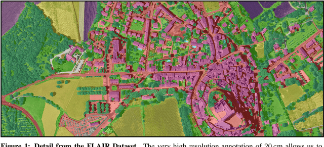
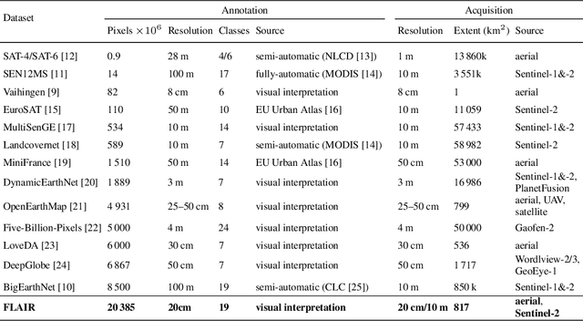

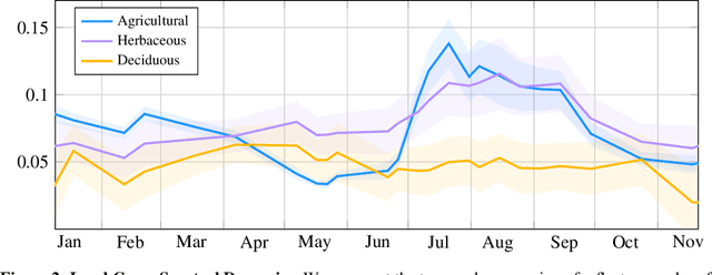
Abstract:We introduce the French Land cover from Aerospace ImageRy (FLAIR), an extensive dataset from the French National Institute of Geographical and Forest Information (IGN) that provides a unique and rich resource for large-scale geospatial analysis. FLAIR contains high-resolution aerial imagery with a ground sample distance of 20 cm and over 20 billion individually labeled pixels for precise land-cover classification. The dataset also integrates temporal and spectral data from optical satellite time series. FLAIR thus combines data with varying spatial, spectral, and temporal resolutions across over 817 km2 of acquisitions representing the full landscape diversity of France. This diversity makes FLAIR a valuable resource for the development and evaluation of novel methods for large-scale land-cover semantic segmentation and raises significant challenges in terms of computer vision, data fusion, and geospatial analysis. We also provide powerful uni- and multi-sensor baseline models that can be employed to assess algorithm's performance and for downstream applications. Through its extent and the quality of its annotation, FLAIR aims to spur improvements in monitoring and understanding key anthropogenic development indicators such as urban growth, deforestation, and soil artificialization. Dataset and codes can be accessed at https://ignf.github.io/FLAIR/
FLAIR #2: textural and temporal information for semantic segmentation from multi-source optical imagery
May 23, 2023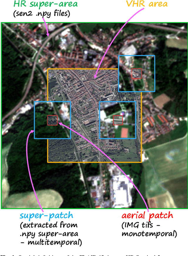
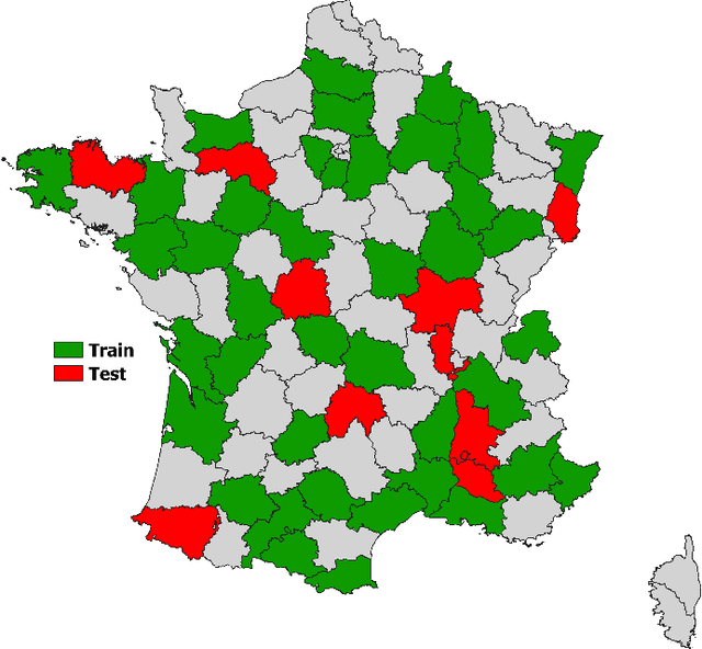
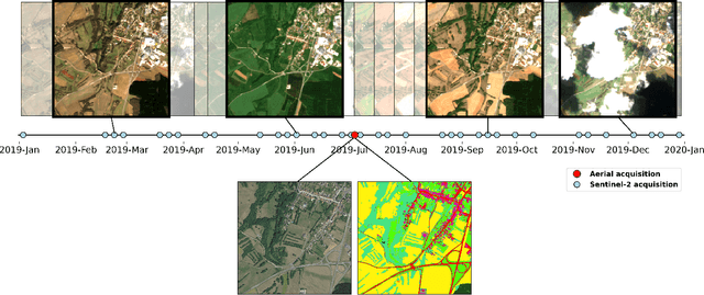
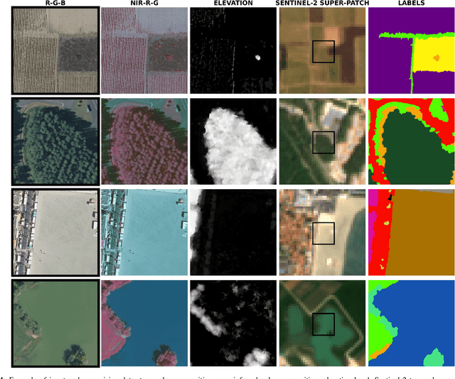
Abstract:The FLAIR #2 dataset hereby presented includes two very distinct types of data, which are exploited for a semantic segmentation task aimed at mapping land cover. The data fusion workflow proposes the exploitation of the fine spatial and textural information of very high spatial resolution (VHR) mono-temporal aerial imagery and the temporal and spectral richness of high spatial resolution (HR) time series of Copernicus Sentinel-2 satellite images. The French National Institute of Geographical and Forest Information (IGN), in response to the growing availability of high-quality Earth Observation (EO) data, is actively exploring innovative strategies to integrate these data with heterogeneous characteristics. IGN is therefore offering this dataset to promote innovation and improve our knowledge of our territories.
FLAIR #1: semantic segmentation and domain adaptation dataset
Dec 04, 2022Abstract:The French National Institute of Geographical and Forest Information (IGN) has the mission to document and measure land-cover on French territory and provides referential geographical datasets, including high-resolution aerial images and topographic maps. The monitoring of land-cover plays a crucial role in land management and planning initiatives, which can have significant socio-economic and environmental impact. Together with remote sensing technologies, artificial intelligence (IA) promises to become a powerful tool in determining land-cover and its evolution. IGN is currently exploring the potential of IA in the production of high-resolution land cover maps. Notably, deep learning methods are employed to obtain a semantic segmentation of aerial images. However, territories as large as France imply heterogeneous contexts: variations in landscapes and image acquisition make it challenging to provide uniform, reliable and accurate results across all of France. The FLAIR-one dataset presented is part of the dataset currently used at IGN to establish the French national reference land cover map "Occupation du sol \`a grande \'echelle" (OCS- GE).
 Add to Chrome
 Add to Firefox
 Add to Edge