Bernd Uebbing
Sea Level Anomaly Prediction using Recurrent Neural Networks
Oct 19, 2017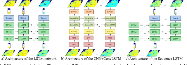

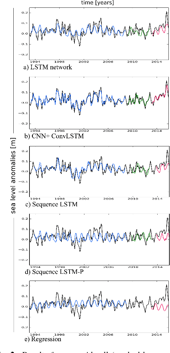
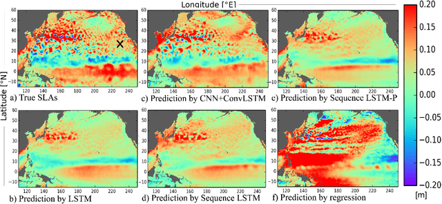
Abstract:Sea level change, one of the most dire impacts of anthropogenic global warming, will affect a large amount of the world's population. However, sea level change is not uniform in time and space, and the skill of conventional prediction methods is limited due to the ocean's internal variabi-lity on timescales from weeks to decades. Here we study the potential of neural network methods which have been used successfully in other applications, but rarely been applied for this task. We develop a combination of a convolutional neural network (CNN) and a recurrent neural network (RNN) to ana-lyse both the spatial and the temporal evolution of sea level and to suggest an independent, accurate method to predict interannual sea level anomalies (SLA). We test our method for the northern and equatorial Pacific Ocean, using gridded altimeter-derived SLA data. We show that the used network designs outperform a simple regression and that adding a CNN improves the skill significantly. The predictions are stable over several years.
STAR: Spatio-Temporal Altimeter Waveform Retracking using Sparse Representation and Conditional Random Fields
Sep 22, 2017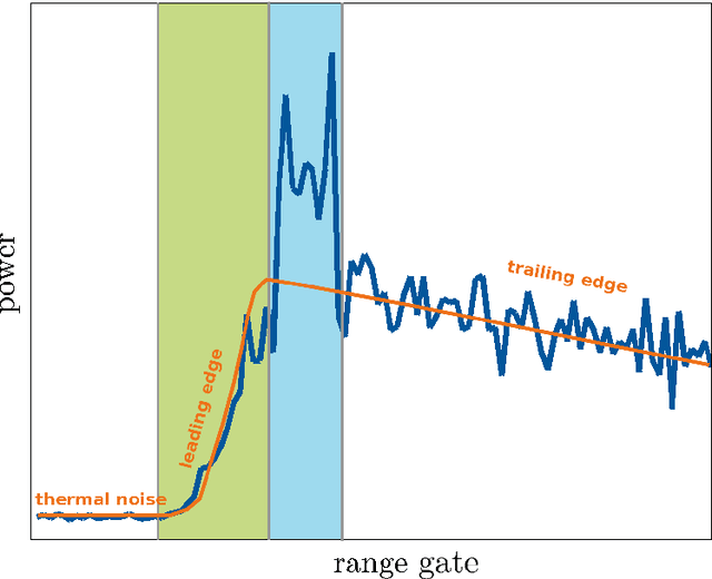

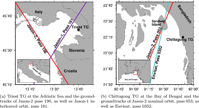

Abstract:Satellite radar altimetry is one of the most powerful techniques for measuring sea surface height variations, with applications ranging from operational oceanography to climate research. Over open oceans, altimeter return waveforms generally correspond to the Brown model, and by inversion, estimated shape parameters provide mean surface height and wind speed. However, in coastal areas or over inland waters, the waveform shape is often distorted by land influence, resulting in peaks or fast decaying trailing edges. As a result, derived sea surface heights are then less accurate and waveforms need to be reprocessed by sophisticated algorithms. To this end, this work suggests a novel Spatio-Temporal Altimetry Retracking (STAR) technique. We show that STAR enables the derivation of sea surface heights over the open ocean as well as over coastal regions of at least the same quality as compared to existing retracking methods, but for a larger number of cycles and thus retaining more useful data. Novel elements of our method are (a) integrating information from spatially and temporally neighboring waveforms through a conditional random field approach, (b) sub-waveform detection, where relevant sub-waveforms are separated from corrupted or non-relevant parts through a sparse representation approach, and (c) identifying the final best set of sea surfaces heights from multiple likely heights using Dijkstra's algorithm. We apply STAR to data from the Jason-1, Jason-2 and Envisat missions for study sites in the Gulf of Trieste, Italy and in the coastal region of the Ganges-Brahmaputra-Meghna estuary, Bangladesh. We compare to several established and recent retracking methods, as well as to tide gauge data. Our experiments suggest that the obtained sea surface heights are significantly less affected by outliers when compared to results obtained by other approaches.
 Add to Chrome
 Add to Firefox
 Add to Edge