Ben Moscona
Detecting Crop Burning in India using Satellite Data
Sep 21, 2022


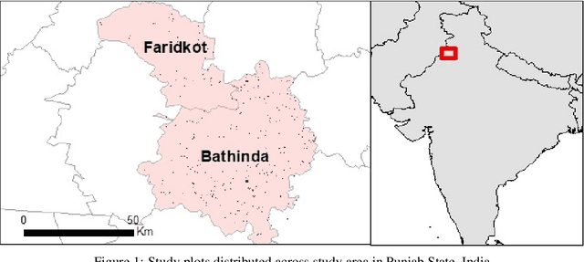
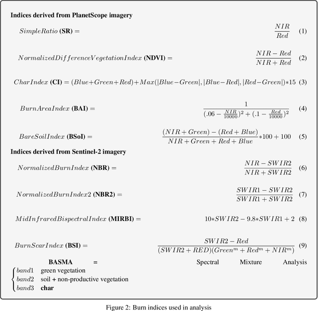
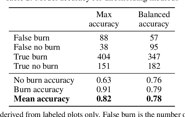
Abstract:Crop residue burning is a major source of air pollution in many parts of the world, notably South Asia. Policymakers, practitioners and researchers have invested in both measuring impacts and developing interventions to reduce burning. However, measuring the impacts of burning or the effectiveness of interventions to reduce burning requires data on where burning occurred. These data are challenging to collect in the field, both in terms of cost and feasibility. We take advantage of data from ground-based monitoring of crop residue burning in Punjab, India to explore whether burning can be detected more effectively using accessible satellite imagery. Specifically, we used 3m PlanetScope data with high temporal resolution (up to daily) as well as publicly-available Sentinel-2 data with weekly temporal resolution but greater depth of spectral information. Following an analysis of the ability of different spectral bands and burn indices to separate burned and unburned plots individually, we built a Random Forest model with those determined to provide the greatest separability and evaluated model performance with ground-verified data. Our overall model accuracy of 82-percent is favorable given the challenges presented by the measurement. Based on insights from this process, we discuss technical challenges of detecting crop residue burning from satellite imagery as well as challenges to measuring impacts, both of burning and of policy interventions.
 Add to Chrome
 Add to Firefox
 Add to Edge