Andrew Michaelis
Spectral Synthesis for Satellite-to-Satellite Translation
Oct 12, 2020Abstract:Earth observing satellites carrying multi-spectral sensors are widely used to monitor the physical and biological states of the atmosphere, land, and oceans. These satellites have different vantage points above the earth and different spectral imaging bands resulting in inconsistent imagery from one to another. This presents challenges in building downstream applications. What if we could generate synthetic bands for existing satellites from the union of all domains? We tackle the problem of generating synthetic spectral imagery for multispectral sensors as an unsupervised image-to-image translation problem with partial labels and introduce a novel shared spectral reconstruction loss. Simulated experiments performed by dropping one or more spectral bands show that cross-domain reconstruction outperforms measurements obtained from a second vantage point. On a downstream cloud detection task, we show that generating synthetic bands with our model improves segmentation performance beyond our baseline. Our proposed approach enables synchronization of multispectral data and provides a basis for more homogeneous remote sensing datasets.
Progressively Growing Generative Adversarial Networks for High Resolution Semantic Segmentation of Satellite Images
Feb 12, 2019
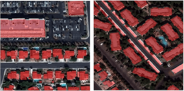
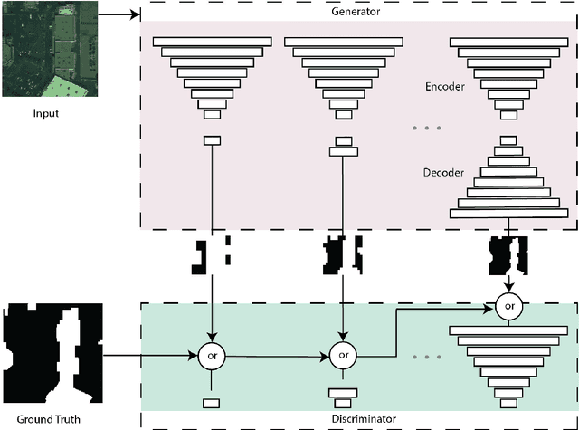

Abstract:Machine learning has proven to be useful in classification and segmentation of images. In this paper, we evaluate a training methodology for pixel-wise segmentation on high resolution satellite images using progressive growing of generative adversarial networks. We apply our model to segmenting building rooftops and compare these results to conventional methods for rooftop segmentation. We present our findings using the SpaceNet version 2 dataset. Progressive GAN training achieved a test accuracy of 93% compared to 89% for traditional GAN training.
DeepSD: Generating High Resolution Climate Change Projections through Single Image Super-Resolution
Mar 09, 2017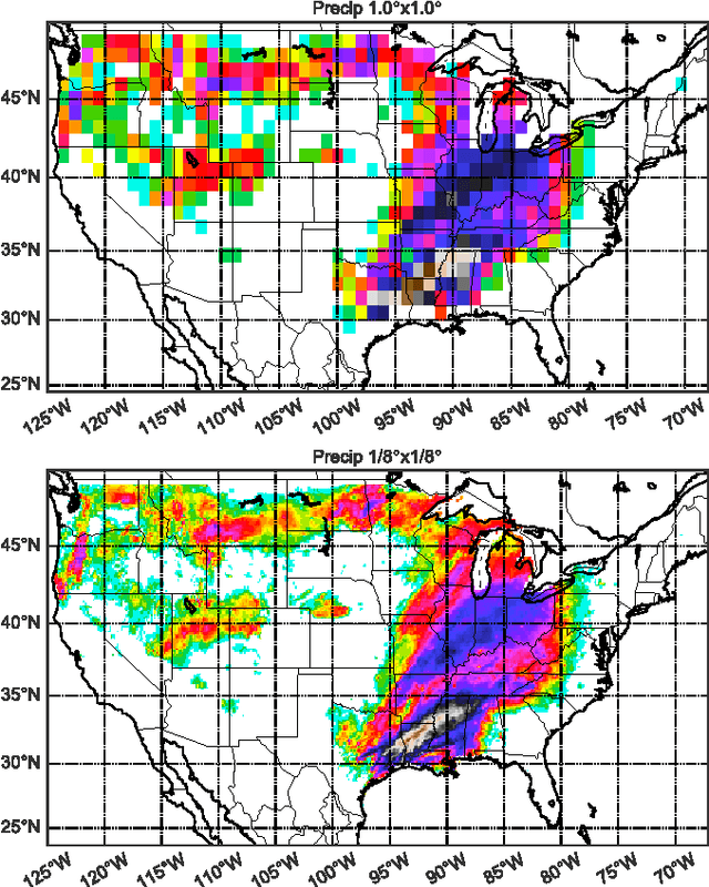
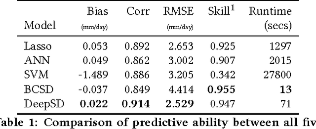
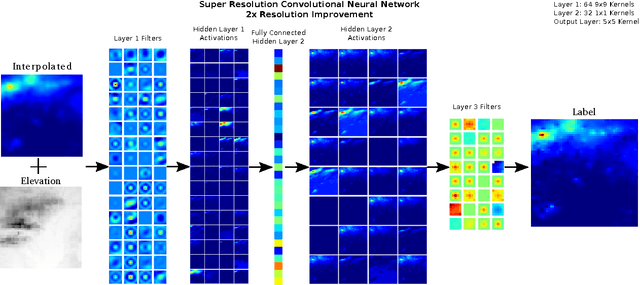
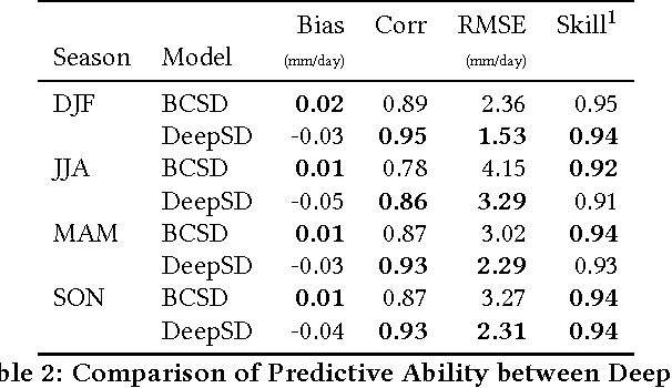
Abstract:The impacts of climate change are felt by most critical systems, such as infrastructure, ecological systems, and power-plants. However, contemporary Earth System Models (ESM) are run at spatial resolutions too coarse for assessing effects this localized. Local scale projections can be obtained using statistical downscaling, a technique which uses historical climate observations to learn a low-resolution to high-resolution mapping. Depending on statistical modeling choices, downscaled projections have been shown to vary significantly terms of accuracy and reliability. The spatio-temporal nature of the climate system motivates the adaptation of super-resolution image processing techniques to statistical downscaling. In our work, we present DeepSD, a generalized stacked super resolution convolutional neural network (SRCNN) framework for statistical downscaling of climate variables. DeepSD augments SRCNN with multi-scale input channels to maximize predictability in statistical downscaling. We provide a comparison with Bias Correction Spatial Disaggregation as well as three Automated-Statistical Downscaling approaches in downscaling daily precipitation from 1 degree (~100km) to 1/8 degrees (~12.5km) over the Continental United States. Furthermore, a framework using the NASA Earth Exchange (NEX) platform is discussed for downscaling more than 20 ESM models with multiple emission scenarios.
 Add to Chrome
 Add to Firefox
 Add to Edge