 Add to Chrome
 Add to Firefox
 Add to Edge
Without Paired Labeled Data: An End-to-End Self-Supervised Paradigm for UAV-View Geo-Localization
Paper and Code
Feb 17, 2025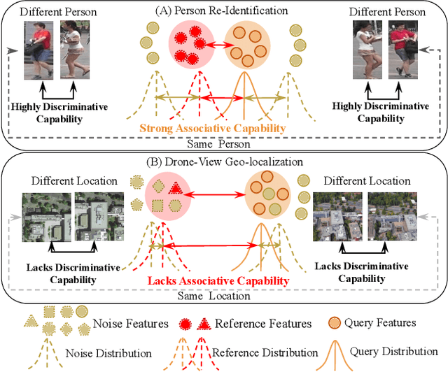
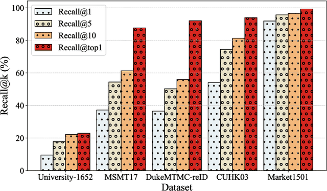
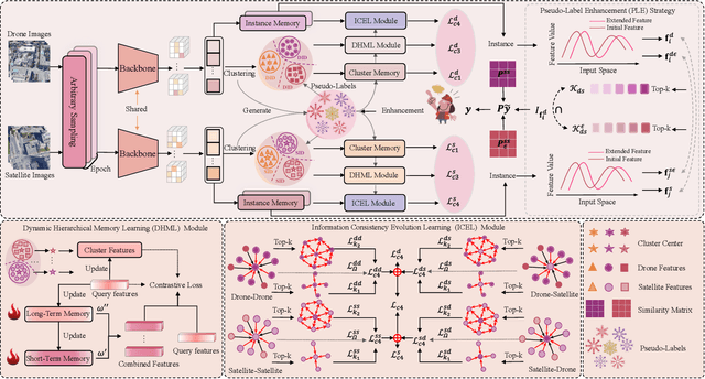
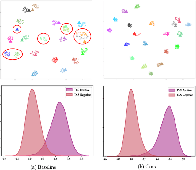
UAV-View Geo-Localization (UVGL) aims to ascertain the precise location of a UAV by retrieving the most similar GPS-tagged satellite image. However, existing methods predominantly rely on supervised learning paradigms that necessitate annotated paired data for training, which incurs substantial annotation costs and impedes large-scale deployment. To overcome this limitation, we propose the Dynamic Memory-Driven and Neighborhood Information Learning (DMNIL) network, a lightweight end-to-end self-supervised framework for UAV-view geo-localization. The DMNIL framework utilizes a dual-path clustering-based contrastive learning architecture as its baseline to model intra-view structural relationships, enhancing feature consistency and discriminability. Additionally, a dynamic memory-driven hierarchical learning module is proposed to progressively mine local and global information, reinforcing multi-level feature associations to improve model robustness. To bridge the domain gap between UAV and satellite views, we design an information-consistent evolutionary learning mechanism that systematically explores latent correlations within intra-view neighborhoods and across cross-view domains, ultimately constructing a unified cross-view feature representation space. Extensive experiments on three benchmarks (University-1652, SUES-200, and DenseUAV) demonstrate that DMNIL achieves competitive performance against state-of-the-art supervised methods while maintaining computational efficiency. Notably, this superiority is attained without relying on paired training data, underscoring the framework's practicality for real-world deployment. Codes will be released soon.