Volumetric Data Fusion of External Depth and Onboard Proximity Data For Occluded Space Reduction
Paper and Code
Oct 21, 2021


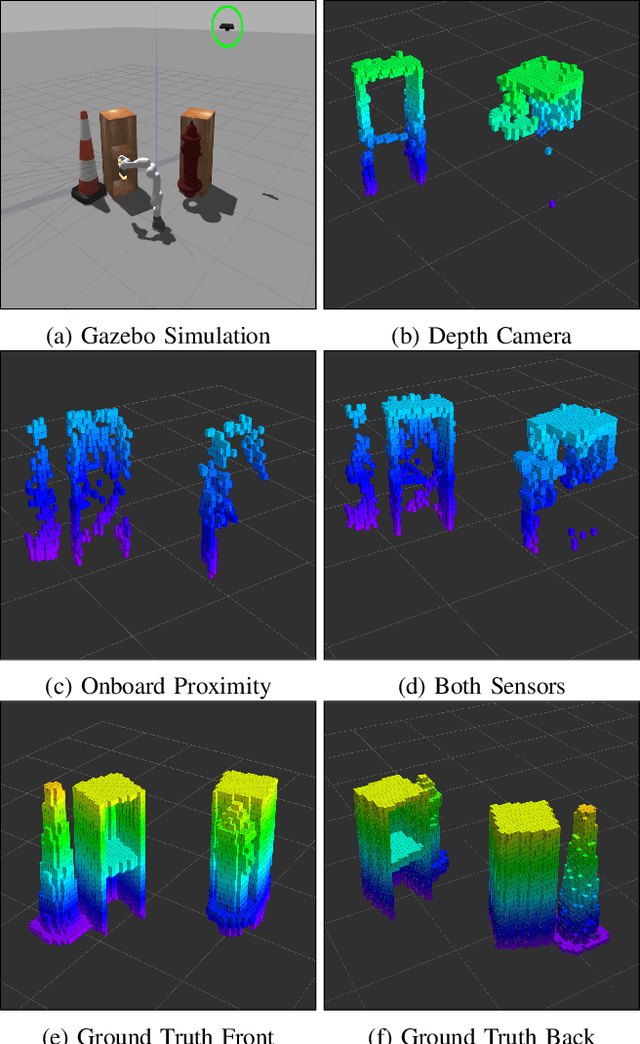
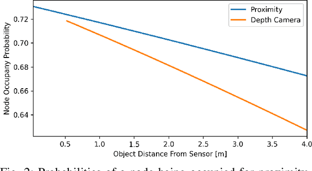
In this work, we present a method for a probabilistic fusion of external depth and onboard proximity data to form a volumetric 3-D map of a robot's environment. We extend the Octomap framework to update a representation of the area around the robot, dependent on each sensor's optimal range of operation. Areas otherwise occluded from an external view are sensed with onboard sensors to construct a more comprehensive map of a robot's nearby space. Our simulated results show that a more accurate map with less occlusions can be generated by fusing external depth and onboard proximity data.
* 3 pages, 2021 IEEE/RSJ International Conference on Intelligent Robots
and Systems (IROS 2021) 4th Workshop on Proximity Perception
 Add to Chrome
 Add to Firefox
 Add to Edge