V2I-Calib++: A Multi-terminal Spatial Calibration Approach in Urban Intersections for Collaborative Perception
Paper and Code
Oct 14, 2024


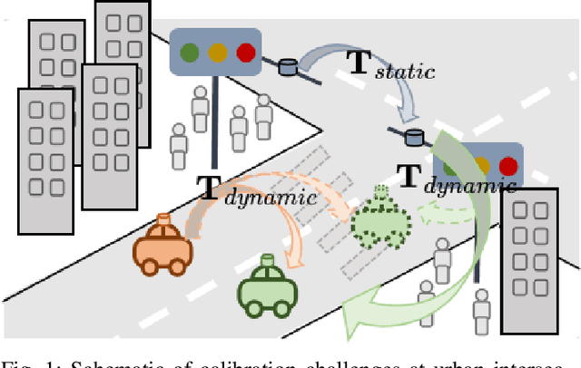
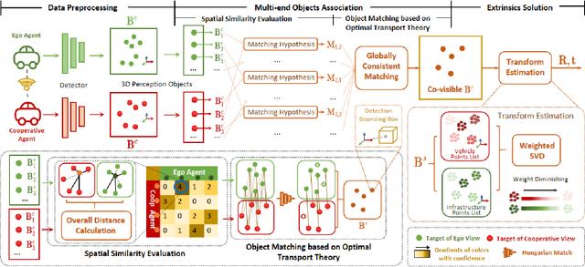
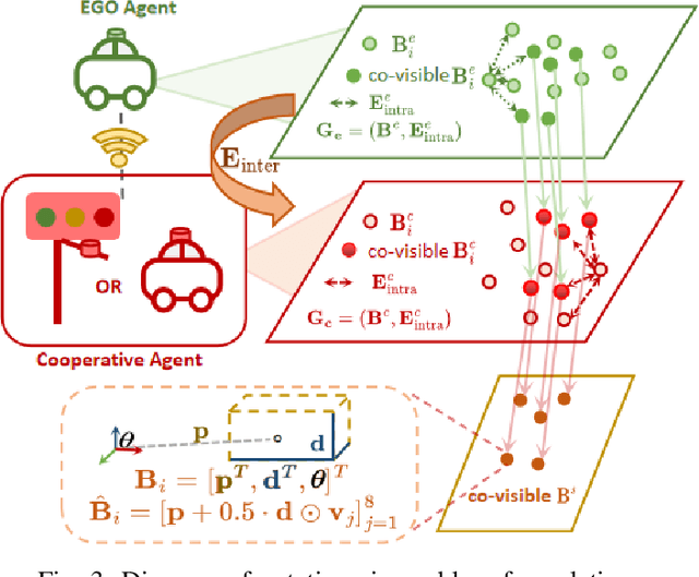
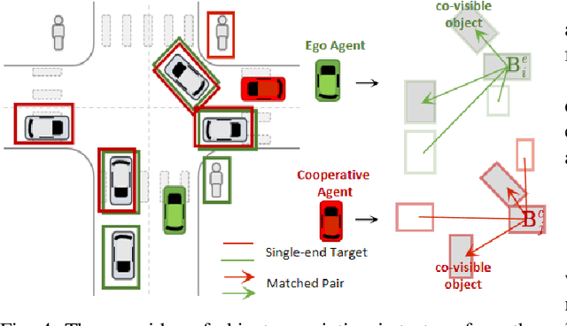
Urban intersections, dense with pedestrian and vehicular traffic and compounded by GPS signal obstructions from high-rise buildings, are among the most challenging areas in urban traffic systems. Traditional single-vehicle intelligence systems often perform poorly in such environments due to a lack of global traffic flow information and the ability to respond to unexpected events. Vehicle-to-Everything (V2X) technology, through real-time communication between vehicles (V2V) and vehicles to infrastructure (V2I), offers a robust solution. However, practical applications still face numerous challenges. Calibration among heterogeneous vehicle and infrastructure endpoints in multi-end LiDAR systems is crucial for ensuring the accuracy and consistency of perception system data. Most existing multi-end calibration methods rely on initial calibration values provided by positioning systems, but the instability of GPS signals due to high buildings in urban canyons poses severe challenges to these methods. To address this issue, this paper proposes a novel multi-end LiDAR system calibration method that does not require positioning priors to determine initial external parameters and meets real-time requirements. Our method introduces an innovative multi-end perception object association technique, utilizing a new Overall Distance metric (oDist) to measure the spatial association between perception objects, and effectively combines global consistency search algorithms with optimal transport theory. By this means, we can extract co-observed targets from object association results for further external parameter computation and optimization. Extensive comparative and ablation experiments conducted on the simulated dataset V2X-Sim and the real dataset DAIR-V2X confirm the effectiveness and efficiency of our method. The code for this method can be accessed at: \url{https://github.com/MassimoQu/v2i-calib}.
 Add to Chrome
 Add to Firefox
 Add to Edge