Understanding human mobility patterns in Chicago: an analysis of taxi data using clustering techniques
Paper and Code
Jun 21, 2023
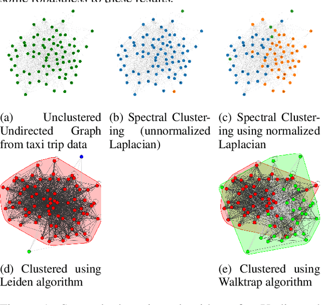
Understanding human mobility patterns is important in applications as diverse as urban planning, public health, and political organizing. One rich source of data on human mobility is taxi ride data. Using the city of Chicago as a case study, we examine data from taxi rides in 2016 with the goal of understanding how neighborhoods are interconnected. This analysis will provide a sense of which neighborhoods individuals are using taxis to travel between, suggesting regions to focus new public transit development efforts. Additionally, this analysis will map traffic circulation patterns and provide an understanding of where in the city people are traveling from and where they are heading to - perhaps informing traffic or road pollution mitigation efforts. For the first application, representing the data as an undirected graph will suffice. Transit lines run in both directions so simply a knowledge of which neighborhoods have high rates of taxi travel between them provides an argument for placing public transit along those routes. However, in order to understand the flow of people throughout a city, we must make a distinction between the neighborhood from which people are departing and the areas to which they are arriving - this requires methods that can deal with directed graphs. All developed codes can be found at https://github.com/Nikunj-Gupta/Spectral-Clustering-Directed-Graphs.
 Add to Chrome
 Add to Firefox
 Add to Edge