Towards Sustainable Census Independent Population Estimation in Mozambique
Paper and Code
Apr 26, 2021


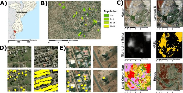
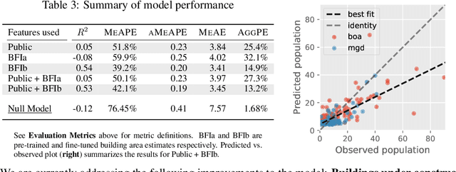
Reliable and frequent population estimation is key for making policies around vaccination and planning infrastructure delivery. Since censuses lack the spatio-temporal resolution required for these tasks, census-independent approaches, using remote sensing and microcensus data, have become popular. We estimate intercensal population count in two pilot districts in Mozambique. To encourage sustainability, we assess the feasibility of using publicly available datasets to estimate population. We also explore transfer learning with existing annotated datasets for predicting building footprints, and training with additional `dot' annotations from regions of interest to enhance these estimations. We observe that population predictions improve when using footprint area estimated with this approach versus only publicly available features.
 Add to Chrome
 Add to Firefox
 Add to Edge