Towards a Knowledge guided Multimodal Foundation Model for Spatio-Temporal Remote Sensing Applications
Paper and Code
Jul 29, 2024


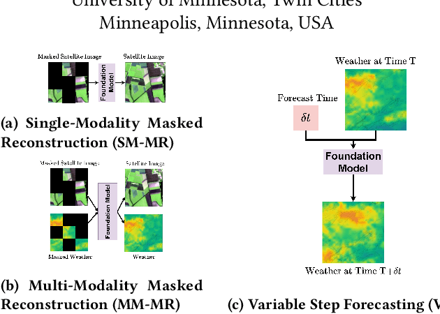
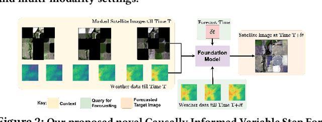
In recent years, there is increased interest in foundation models for geoscience due to vast amount of earth observing satellite imagery. Existing remote sensing foundation models make use of the various sources of spectral imagery to create large models pretrained on masked reconstruction task. The embeddings from these foundation models are then used for various downstream remote sensing applications. In this paper we propose a foundational modeling framework for remote sensing geoscience applications, that goes beyond these traditional single modality masked autoencoder family of foundation models. This framework leverages the knowledge guided principles that the spectral imagery captures the impact of the physical drivers on the environmental system, and that the relationship between them is governed by the characteristics of the system. Specifically, our method, called MultiModal Variable Step Forecasting (MM-VSF), uses mutlimodal data (spectral imagery and weather) as its input and a variable step forecasting task as its pretraining objective. In our evaluation we show forecasting of satellite imagery using weather can be used as an effective pretraining task for foundation models. We further show the effectiveness of the embeddings from MM-VSF on the downstream task of pixel wise crop mapping, when compared with a model trained in the traditional setting of single modality input and masked reconstruction based pretraining.
 Add to Chrome
 Add to Firefox
 Add to Edge