Superpixels and Graph Convolutional Neural Networks for Efficient Detection of Nutrient Deficiency Stress from Aerial Imagery
Paper and Code
Apr 22, 2021


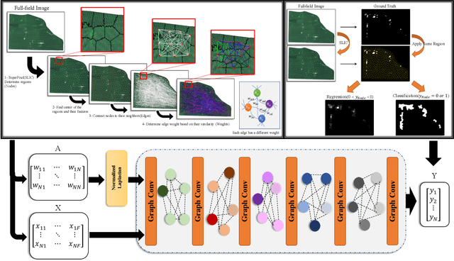
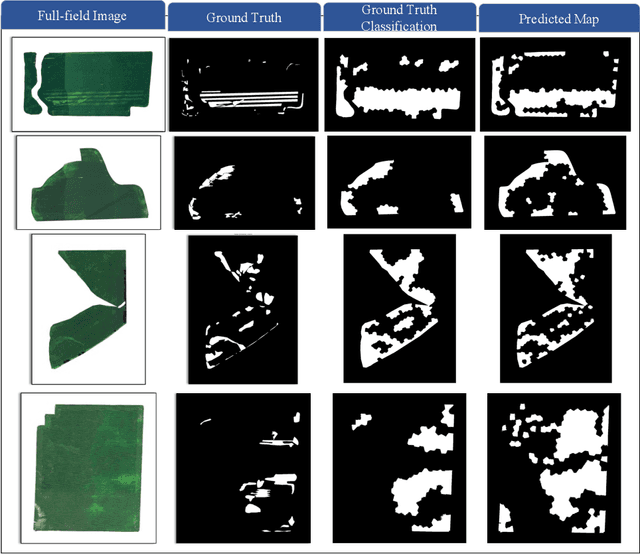
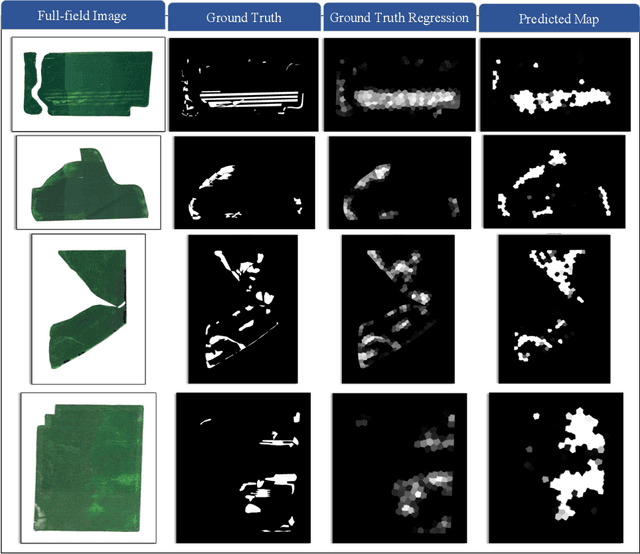
Advances in remote sensing technology have led to the capture of massive amounts of data. Increased image resolution, more frequent revisit times, and additional spectral channels have created an explosion in the amount of data that is available to provide analyses and intelligence across domains, including agriculture. However, the processing of this data comes with a cost in terms of computation time and money, both of which must be considered when the goal of an algorithm is to provide real-time intelligence to improve efficiencies. Specifically, we seek to identify nutrient deficient areas from remotely sensed data to alert farmers to regions that require attention; detection of nutrient deficient areas is a key task in precision agriculture as farmers must quickly respond to struggling areas to protect their harvests. Past methods have focused on pixel-level classification (i.e. semantic segmentation) of the field to achieve these tasks, often using deep learning models with tens-of-millions of parameters. In contrast, we propose a much lighter graph-based method to perform node-based classification. We first use Simple Linear Iterative Cluster (SLIC) to produce superpixels across the field. Then, to perform segmentation across the non-Euclidean domain of superpixels, we leverage a Graph Convolutional Neural Network (GCN). This model has 4-orders-of-magnitude fewer parameters than a CNN model and trains in a matter of minutes.
 Add to Chrome
 Add to Firefox
 Add to Edge