Slum Segmentation and Change Detection : A Deep Learning Approach
Paper and Code
Nov 19, 2018


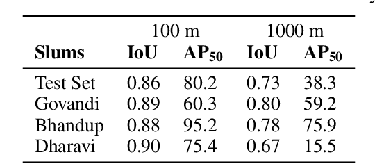
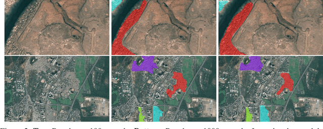
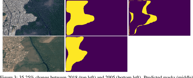
More than one billion people live in slums around the world. In some developing countries, slum residents make up for more than half of the population and lack reliable sanitation services, clean water, electricity, other basic services. Thus, slum rehabilitation and improvement is an important global challenge, and a significant amount of effort and resources have been put into this endeavor. These initiatives rely heavily on slum mapping and monitoring, and it is essential to have robust and efficient methods for mapping and monitoring existing slum settlements. In this work, we introduce an approach to segment and map individual slums from satellite imagery, leveraging regional convolutional neural networks for instance segmentation using transfer learning. In addition, we also introduce a method to perform change detection and monitor slum change over time. We show that our approach effectively learns slum shape and appearance, and demonstrates strong quantitative results, resulting in a maximum AP of 80.0.
 Add to Chrome
 Add to Firefox
 Add to Edge