Roadside Lidar Vehicle Detection and Tracking Using Range And Intensity Background Subtraction
Paper and Code
Jan 14, 2022


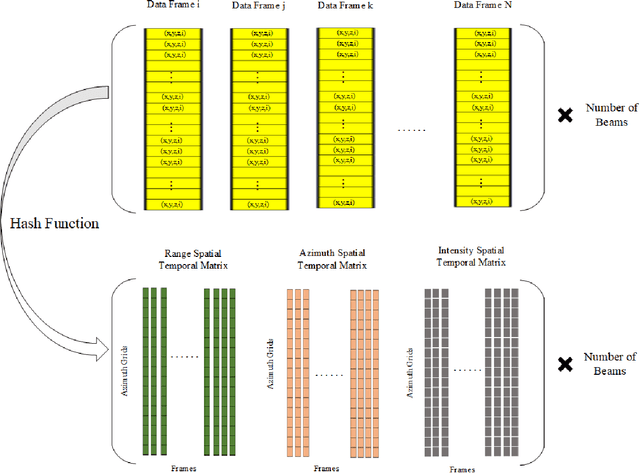
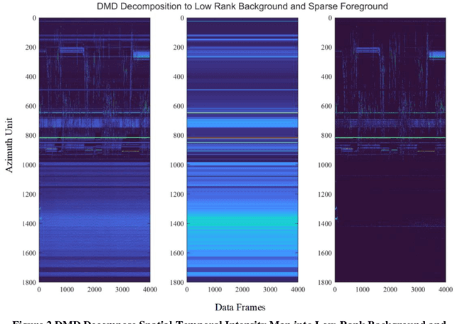
In this paper, we present the solution of roadside LiDAR object detection using a combination of two unsupervised learning algorithms. The 3D point clouds data are firstly converted into spherical coordinates and filled into the azimuth grid matrix using a hash function. After that, the raw LiDAR data were rearranged into spatial-temporal data structures to store the information of range, azimuth, and intensity. Dynamic Mode Decomposition method is applied for decomposing the point cloud data into low-rank backgrounds and sparse foregrounds based on intensity channel pattern recognition. The Triangle Algorithm automatically finds the dividing value to separate the moving targets from static background according to range information. After intensity and range background subtraction, the foreground moving objects will be detected using a density-based detector and encoded into the state-space model for tracking. The output of the proposed model includes vehicle trajectories that can enable many mobility and safety applications. The method was validated against a commercial traffic data collection platform and demonstrated to be an efficient and reliable solution for infrastructure LiDAR object detection. In contrast to the previous methods that process directly on the scattered and discrete point clouds, the proposed method can establish the less sophisticated linear relationship of the 3D measurement data, which captures the spatial-temporal structure that we often desire.
 Add to Chrome
 Add to Firefox
 Add to Edge