Recent Ice Trends in Swiss Mountain Lakes: 20-year Analysis of MODIS Imagery
Paper and Code
Mar 23, 2021


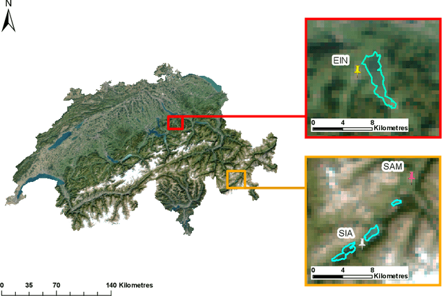
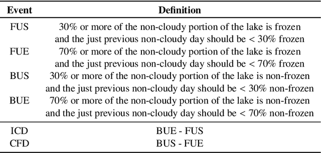
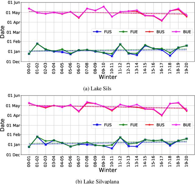
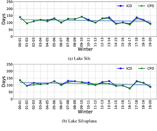
Depleting lake ice can serve as an indicator for climate change, just like sea level rise or glacial retreat. Several Lake Ice Phenological (LIP) events serve as sentinels to understand the regional and global climate change. Hence, monitoring the long-term lake freezing and thawing patterns can prove very useful. In this paper, we focus on observing the LIP events such as freeze-up, break-up and temporal freeze extent in the Oberengadin region of Switzerland, where there are several small- and medium-sized mountain lakes, across two decades (2000-2020) from optical satellite images. We analyse time-series of MODIS imagery (and additionally cross-check with VIIRS data when available), by estimating spatially resolved maps of lake ice for these Alpine lakes with supervised machine learning. To train the classifier we rely on reference data annotated manually based on publicly available webcam images. From the ice maps we derive long-term LIP trends. Since the webcam data is only available for two winters, we also validate our results against the operational MODIS and VIIRS snow products. We find a change in Complete Freeze Duration (CFD) of -0.76 and -0.89 days per annum (d/a) for lakes Sils and Silvaplana respectively. Furthermore, we correlate the lake freezing and thawing trends with climate data such as temperature, sunshine, precipitation and wind measured at nearby meteorological stations.
 Add to Chrome
 Add to Firefox
 Add to Edge