Learning from Discovering: An unsupervised approach to Geographical Knowledge Discovery using street level and street network images
Paper and Code
Jun 18, 2019


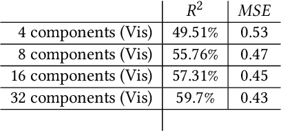
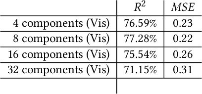
Recent researches have shown the increasing use of machine learning methods in geography and urban analytics, primarily to extract features and patterns from spatial and temporal data. Research, integrating geographical processes in machine learning models and, leveraging on geographical information to better interpret these methods had been sparse. This research contributes to the ladder, where we show how latent variables learned from unsupervised learning methods can be used for geographic knowledge discovery. In particular, we propose a simple and novel approach called Convolutional-PCA (ConvPCA) which are applied on both street level and street network images in finding a set of uncorrelated visual latent responses. The approach allows for meaningful explanations using a combination of, geographical and generative visualizations to explore the latent space, and to show how the learned embeddings can be used to predict urban characteristics such as street-level enclosures and street network density.
 Add to Chrome
 Add to Firefox
 Add to Edge