Improving Interpretability of Deep Active Learning for Flood Inundation Mapping Through Class Ambiguity Indices Using Multi-spectral Satellite Imagery
Paper and Code
Apr 29, 2024


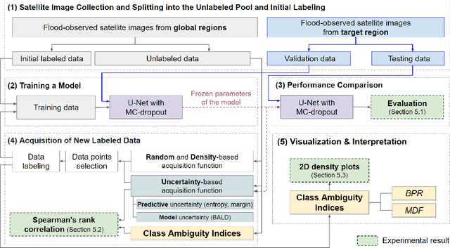
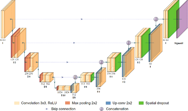
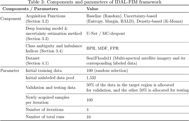
Flood inundation mapping is a critical task for responding to the increasing risk of flooding linked to global warming. Significant advancements of deep learning in recent years have triggered its extensive applications, including flood inundation mapping. To cope with the time-consuming and labor-intensive data labeling process in supervised learning, deep active learning strategies are one of the feasible approaches. However, there remains limited exploration into the interpretability of how deep active learning strategies operate, with a specific focus on flood inundation mapping in the field of remote sensing. In this study, we introduce a novel framework of Interpretable Deep Active Learning for Flood inundation Mapping (IDAL-FIM), specifically in terms of class ambiguity of multi-spectral satellite images. In the experiments, we utilize Sen1Floods11 dataset, and adopt U-Net with MC-dropout. In addition, we employ five acquisition functions, which are the random, K-means, BALD, entropy, and margin acquisition functions. Based on the experimental results, we demonstrate that two proposed class ambiguity indices are effective variables to interpret the deep active learning by establishing statistically significant correlation with the predictive uncertainty of the deep learning model at the tile level. Then, we illustrate the behaviors of deep active learning through visualizing two-dimensional density plots and providing interpretations regarding the operation of deep active learning, in flood inundation mapping.
 Add to Chrome
 Add to Firefox
 Add to Edge