High Resolution Forecasting of Heat Waves impacts on Leaf Area Index by Multiscale Multitemporal Deep Learning
Paper and Code
Sep 13, 2019


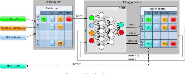
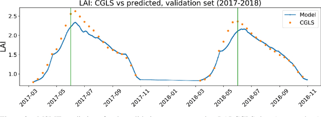
Climate change impacts could cause progressive decrease of crop quality and yield, up to harvest failures. In particular, heat waves and other climate extremes can lead to localized food shortages and even threaten food security of communities worldwide. In this study, we apply a deep learning architecture for high resolution forecasting (300 m, 10 days) of the Leaf Area Index (LAI), whose dynamics has been widely used to model the growth phase of crops and impact of heat waves. LAI models can be computed at 0.1 degree spatial resolution with an auto regressive component adjusted with weather conditions, validated with remote sensing measurements. However model actionability is poor in regions of varying terrain morphology at this scale (about 8 km at the Alps latitude). Our deep learning model aims instead at forecasting LAI by training multiscale multitemporal (MSMT) data from the Copernicus Global Land Service (CGLS) project for all Europe at 300m resolution and medium-resolution historical weather data. Further, the deep learning model inputs integrate high-resolution land surface features, known to improve forecasts of agricultural productivity. The historical weather data are then replaced with forecast values to predict LAI values at 10 day horizon on Europe. We propose the MSMT model to develop a high resolution crop-specific warning system for mitigating damage due to heat waves and other extreme events.
 Add to Chrome
 Add to Firefox
 Add to Edge