Geoseg: A Computer Vision Package for Automatic Building Segmentation and Outline Extraction
Paper and Code
Sep 10, 2018


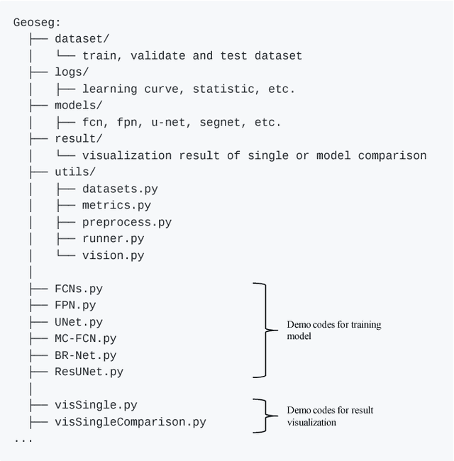
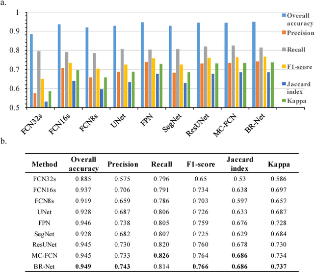
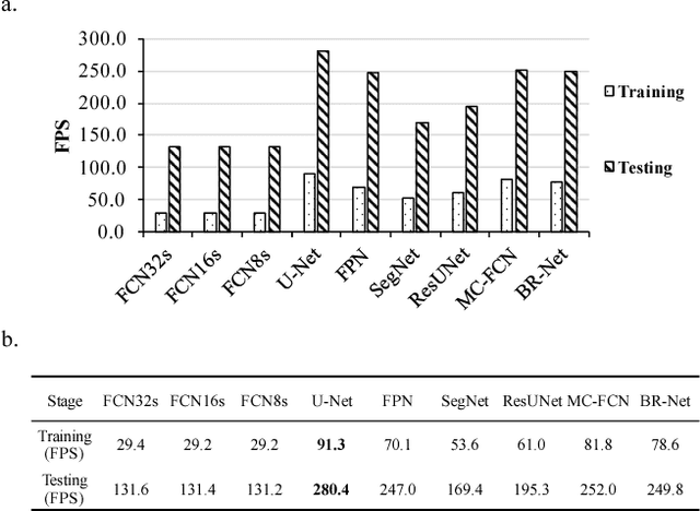
Recently, deep learning algorithms, especially fully convolutional network based methods, are becoming very popular in the field of remote sensing. However, these methods are implemented and evaluated through various datasets and deep learning frameworks. There has not been a package that covers these methods in a unifying manner. In this study, we introduce a computer vision package termed Geoseg that focus on building segmentation and outline extraction. Geoseg implements over nine state-of-the-art models as well as utility scripts needed to conduct model training, logging, evaluating and visualization. The implementation of Geoseg emphasizes unification, simplicity, and flexibility. The performance and computational efficiency of all implemented methods are evaluated by comparison experiment through a unified, high-quality aerial image dataset.
 Add to Chrome
 Add to Firefox
 Add to Edge