GEOSCAN: Global Earth Observation using Swarm of Coordinated Autonomous Nanosats
Paper and Code
Nov 27, 2021


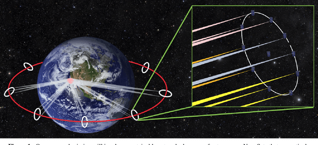
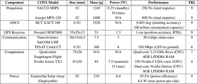
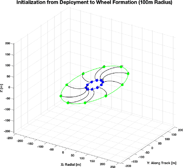
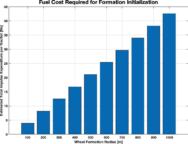
The climate crisis we are facing calls for significant improvements in our understanding of natural phenomena, with clouds being identified as a dominant source of uncertainty. To this end, the emerging field of 3D computed cloud tomography (CCT) aims to more precisely characterize clouds by utilizing multi-dimensional imaging to reconstruct their outer and inner structure. In this paper, we propose a future Earth observation mission concept, driven by the needs of CCT, that operates constellation of NanoSats to provide multi-angular, spectrally-resolved, spatial and temporal scientific measurements of natural atmospheric phenomena. Our proposed mission, GEOSCAN, will on-board active steering capability to rapidly reconfigure networked swarm of autonomous Nanosats to track evolving phenomena of interest, on-demand, in real-time. We present the structure of the GEOSCAN constellation and discuss details of the mission concept from both science and engineering perspectives. On the science side, we outline the types of remote Earth observation measurements that GEOSCAN enables beyond the state-of-the-art, and how such measurements translate to improvements in CCT that can lead to reduction in uncertainty of the global climate models (GCMs). From the engineering side, we investigate feasibility of the concept starting from hardware components of the NanoSat that form the basis of the constellation. In particular, we focus on the active steering capability of the GEOSCAN with algorithmic approaches that enable coordination from new software. We identify technology gaps that need to be bridged and discuss other aspects of the mission that require in-depth analysis to further mature the concept.
 Add to Chrome
 Add to Firefox
 Add to Edge