Exploring Urban Air Quality with MAPS: Mobile Air Pollution Sensing
Paper and Code
Apr 28, 2019


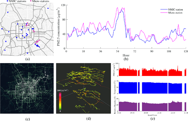
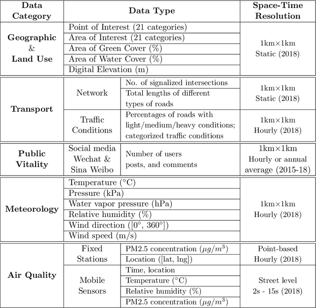
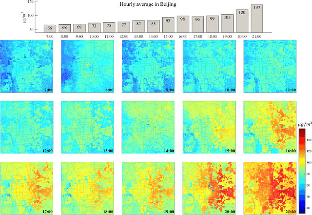
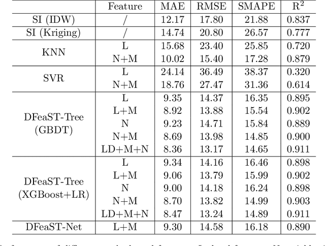
Mobile and ubiquitous sensing of urban air quality (AQ) has received increased attention as an economically and operationally viable means to survey atmospheric environment with high spatial-temporal resolution. A necessary and value-added step towards data-driven sustainable urban management is fine-granular AQ inference, which estimates grid-level pollutant concentrations at every instance of time using AQ data collected from fixed-location and mobile sensors. We present the Mobile Air Pollution Sensing (MAPS) framework, which consists of data preprocessing, urban feature extraction, and AQ inference. This is applied to a case study in Beijing (3,025 square km, 19 June - 16 July 2018), where PM2.5 concentrations measured by 28 fixed monitoring stations and 15 vehicles are fused to infer hourly PM2.5 concentrations in 3,025 1km-by-1km grids. Two machine learning structures, namely Deep Feature Spatial-Temporal Tree (DFeaST-Tree) and Deep Feature Spatial-Temporal Network (DFeaST-Net), are proposed to infer PM2.5 concentrations supported by 62 types of urban data that encompass geography, land use, traffic, public, and meteorology. This allows us to infer fine-granular PM2.5 concentrations based on sparse AQ measurements (less than 5% coverage) with good accuracy (SMAPE<15%, R-square>0.9), while accounting for the regional transport of air pollutants outside the study area. In-depth discussions are provided on the heterogeneity of fixed and mobile data sources, spatial coverage of mobile sensing, and importance of urban features for inferring PM2.5 concentrations.
 Add to Chrome
 Add to Firefox
 Add to Edge