Enabling High-Precision 5G mmWave-Based Positioning for Autonomous Vehicles in Dense Urban Environments
Paper and Code
May 04, 2023


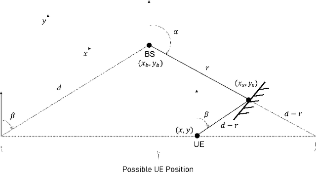
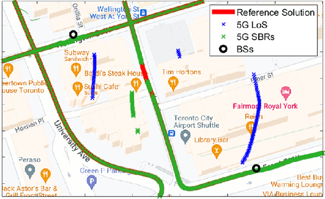
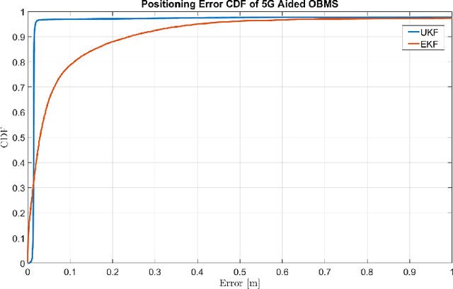
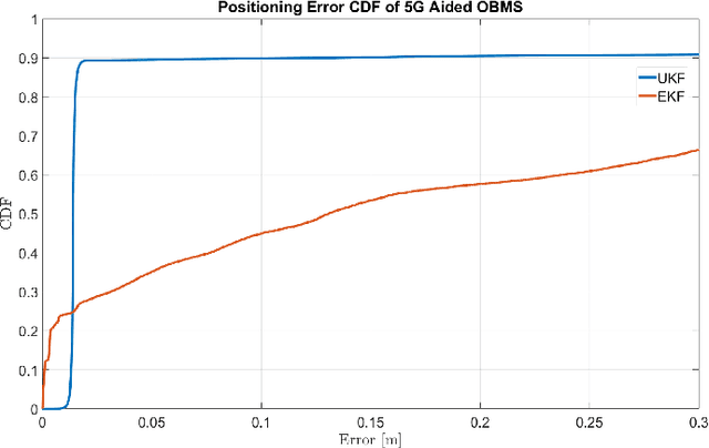
5G-based mmWave wireless positioning has emerged as a promising solution for autonomous vehicle (AV) positioning in recent years. Previous studies have highlighted the benefits of fusing a line-of-sight (LoS) 5G positioning solution with an Inertial Navigation System (INS) for an improved positioning solution. However, the highly dynamic environment of urban areas, where AVs are expected to operate, poses a challenge, as non-line-of-sight (NLoS) communication can deteriorate the 5G mmWave positioning solution and lead to erroneous corrections to the INS. To address this challenge, we exploit 5G multipath and LoS signals to improve positioning performance in dense urban environments. In addition, we integrate the proposed 5G-based positioning with low-cost onboard motion sensors (OBMS). Moreover, the integration is realized using an unscented Kalman filter (UKF) as an alternative to the widely utilized EKF as a fusion engine to avoid ignoring the higher-order and non-linear terms of the dynamic system model. We also introduce techniques to evaluate the quality of each LoS and multipath measurement prior to incorporation into the filter's correction stage. To validate the proposed methodologies, we performed two test trajectories in the dense urban environment of downtown Toronto, Canada. For each trajectory, quasi-real 5G measurements were collected using a ray-tracing tool incorporating 3D map scans of real-world buildings, allowing for realistic multipath scenarios. For the same trajectories, real OBMS data were collected from two-different low-cost IMUs. Our integrated positioning solution was capable of maintaining a level of accuracy below 30 cm for approximately 97% of the time, which is superior to the accuracy level achieved when multipath signals are not considered, which is only around 91% of the time.
 Add to Chrome
 Add to Firefox
 Add to Edge