Dynamic Benchmarks: Spatial and Temporal Alignment for ADS Performance Evaluation
Paper and Code
Oct 11, 2024


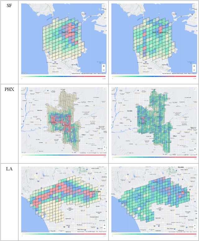
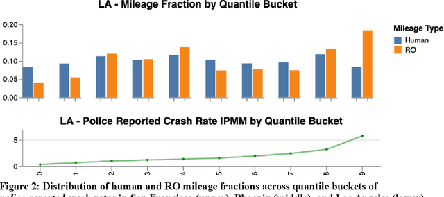
Deployed SAE level 4+ Automated Driving Systems (ADS) without a human driver are currently operational ride-hailing fleets on surface streets in the United States. This current use case and future applications of this technology will determine where and when the fleets operate, potentially resulting in a divergence from the distribution of driving of some human benchmark population within a given locality. Existing benchmarks for evaluating ADS performance have only done county-level geographical matching of the ADS and benchmark driving exposure in crash rates. This study presents a novel methodology for constructing dynamic human benchmarks that adjust for spatial and temporal variations in driving distribution between an ADS and the overall human driven fleet. Dynamic benchmarks were generated using human police-reported crash data, human vehicle miles traveled (VMT) data, and over 20 million miles of Waymo's rider-only (RO) operational data accumulated across three US counties. The spatial adjustment revealed significant differences across various severity levels in adjusted crash rates compared to unadjusted benchmarks with these differences ranging from 10% to 47% higher in San Francisco, 12% to 20% higher in Maricopa, and 7% lower to 34% higher in Los Angeles counties. The time-of-day adjustment in San Francisco, limited to this region due to data availability, resulted in adjusted crash rates 2% lower to 16% higher than unadjusted rates, depending on severity level. The findings underscore the importance of adjusting for spatial and temporal confounders in benchmarking analysis, which ultimately contributes to a more equitable benchmark for ADS performance evaluations.
 Add to Chrome
 Add to Firefox
 Add to Edge