Downscaling Extreme Rainfall Using Physical-Statistical Generative Adversarial Learning
Paper and Code
Dec 02, 2022


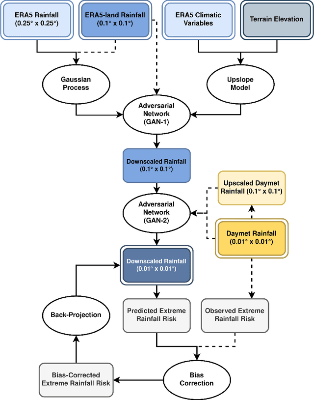
Modeling the risk of extreme weather events in a changing climate is essential for developing effective adaptation and mitigation strategies. Although the available low-resolution climate models capture different scenarios, accurate risk assessment for mitigation and adaption often demands detail that they typically cannot resolve. Here, we develop a dynamic data-driven downscaling (super-resolution) method that incorporates physics and statistics in a generative framework to learn the fine-scale spatial details of rainfall. Our method transforms coarse-resolution ($0.25^{\circ} \times 0.25^{\circ}$) climate model outputs into high-resolution ($0.01^{\circ} \times 0.01^{\circ}$) rainfall fields while efficaciously quantifying uncertainty. Results indicate that the downscaled rainfall fields closely match observed spatial fields and their risk distributions.
 Add to Chrome
 Add to Firefox
 Add to Edge