Building Damage Detection in Satellite Imagery Using Convolutional Neural Networks
Paper and Code
Oct 14, 2019


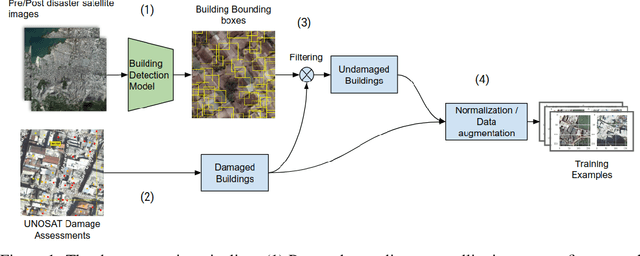
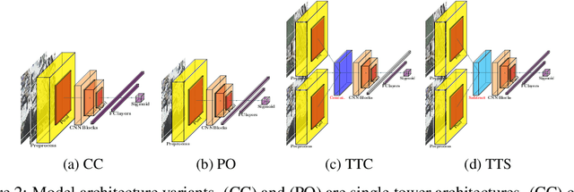
In all types of disasters, from earthquakes to armed conflicts, aid workers need accurate and timely data such as damage to buildings and population displacement to mount an effective response. Remote sensing provides this data at an unprecedented scale, but extracting operationalizable information from satellite images is slow and labor-intensive. In this work, we use machine learning to automate the detection of building damage in satellite imagery. We compare the performance of four different convolutional neural network models in detecting damaged buildings in the 2010 Haiti earthquake. We also quantify how well the models will generalize to future disasters by training and testing models on different disaster events.
 Add to Chrome
 Add to Firefox
 Add to Edge