Addressing the Invisible: Street Address Generation for Developing Countries with Deep Learning
Paper and Code
Nov 10, 2018


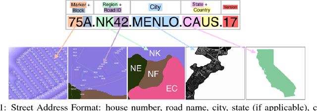
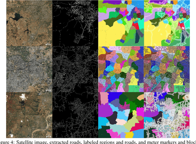
More than half of the world's roads lack adequate street addressing systems. Lack of addresses is even more visible in daily lives of people in developing countries. We would like to object to the assumption that having an address is a luxury, by proposing a generative address design that maps the world in accordance with streets. The addressing scheme is designed considering several traditional street addressing methodologies employed in the urban development scenarios around the world. Our algorithm applies deep learning to extract roads from satellite images, converts the road pixel confidences into a road network, partitions the road network to find neighborhoods, and labels the regions, roads, and address units using graph- and proximity-based algorithms. We present our results on a sample US city, and several developing cities, compare travel times of users using current ad hoc and new complete addresses, and contrast our addressing solution to current industrial and open geocoding alternatives.
 Add to Chrome
 Add to Firefox
 Add to Edge