Adaptive Height Optimisation for Cellular-Connected UAVs using Reinforcement Learning
Paper and Code
Jul 27, 2020


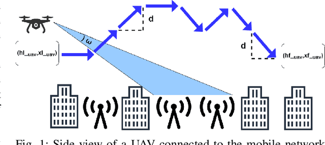
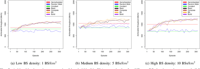
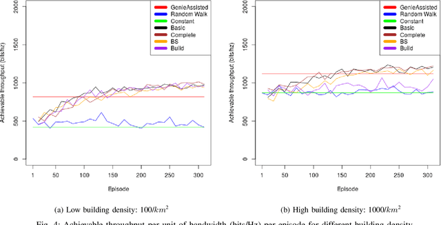
With the increasing number of \acp{uav} as users of the cellular network, the research community faces particular challenges in providing reliable \ac{uav} connectivity. A challenge that has limited research is understanding how the local building and \ac{bs} density affects \ac{uav}'s connection to a cellular network, that in the physical layer is related to its spectrum efficiency. With more \acp{bs}, the \ac{uav} connectivity could be negatively affected as it has \ac{los} to most of them, decreasing its spectral efficiency. On the other hand, buildings could be blocking interference from undesirable \ac{bs}, improving the link of the \ac{uav} to the serving \ac{bs}. This paper proposes a \ac{rl}-based algorithm to optimise the height of a UAV, as it moves dynamically within a range of heights, with the focus of increasing the UAV spectral efficiency. We evaluate the solution for different \ac{bs} and building densities. Our results show that in most scenarios \ac{rl} outperforms the baselines achieving up to 125\% over naive constant baseline, and up to 20\% over greedy approach with up front knowledge of the best height of UAV in the next time step.
 Add to Chrome
 Add to Firefox
 Add to Edge