A New Stereo Benchmarking Dataset for Satellite Images
Paper and Code
Jul 09, 2019


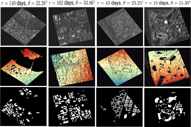
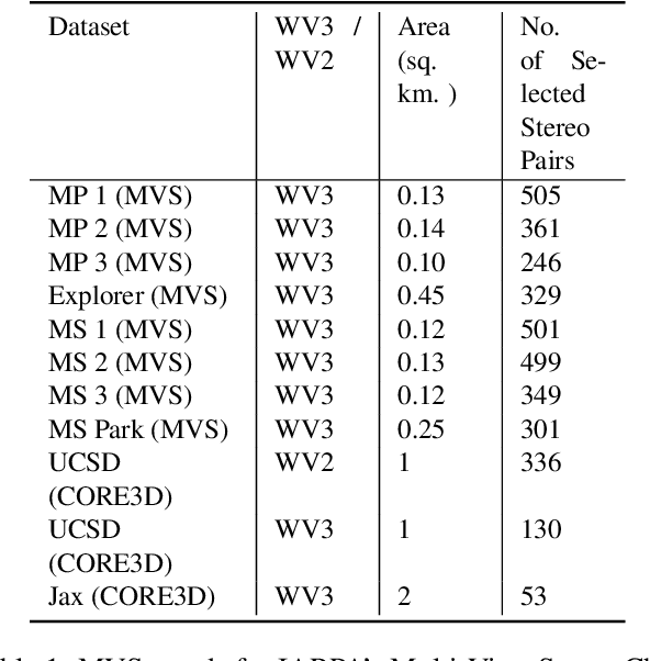
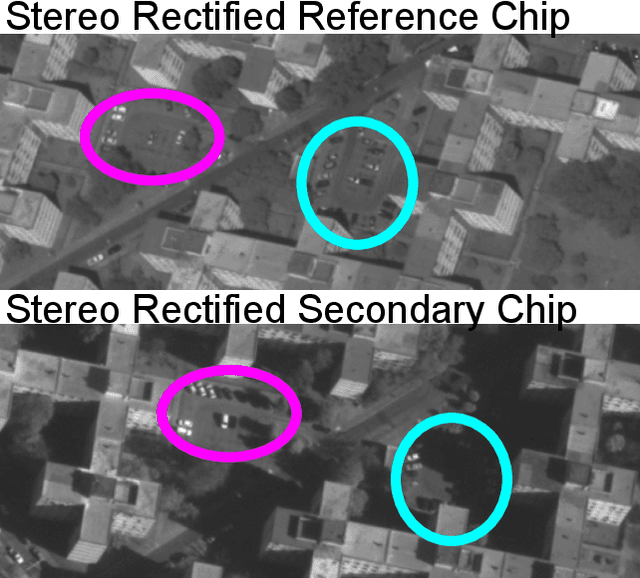
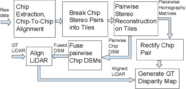
In order to facilitate further research in stereo reconstruction with multi-date satellite images, the goal of this paper is to provide a set of stereo-rectified images and the associated groundtruthed disparities for 10 AOIs (Area of Interest) drawn from two sources: 8 AOIs from IARPA's MVS Challenge dataset and 2 AOIs from the CORE3D-Public dataset. The disparities were groundtruthed by first constructing a fused DSM from the stereo pairs and by aligning 30 cm LiDAR with the fused DSM. Unlike the existing benckmarking datasets, we have also carried out a quantitative evaluation of our groundtruthed disparities using human annotated points in two of the AOIs. Additionally, the rectification accuracy in our dataset is comparable to the same in the existing state-of-the-art stereo datasets. In general, we have used the WorldView-3 (WV3) images for the dataset, the exception being the UCSD area for which we have used both WV3 and WorldView-2 (WV2) images. All of the dataset images are now in the public domain. Since multi-date satellite images frequently include images acquired in different seasons (which creates challenges in finding corresponding pairs of pixels for stereo), our dataset also includes for each image a building mask over which the disparities estimated by stereo should prove reliable. Additional metadata included in the dataset includes information about each image's acquisition date and time, the azimuth and elevation angles of the camera, and the intersection angles for the two views in a stereo pair. Also included in the dataset are both quantitative and qualitative analyses of the accuracy of the groundtruthed disparity maps. Our dataset is available for download at \url{https://engineering.purdue.edu/RVL/Database/SatStereo/index.html}
 Add to Chrome
 Add to Firefox
 Add to Edge