Zaheen E Muktadi Syed
Predicting Real-time Crash Risks during Hurricane Evacuation Using Connected Vehicle Data
Jun 14, 2023


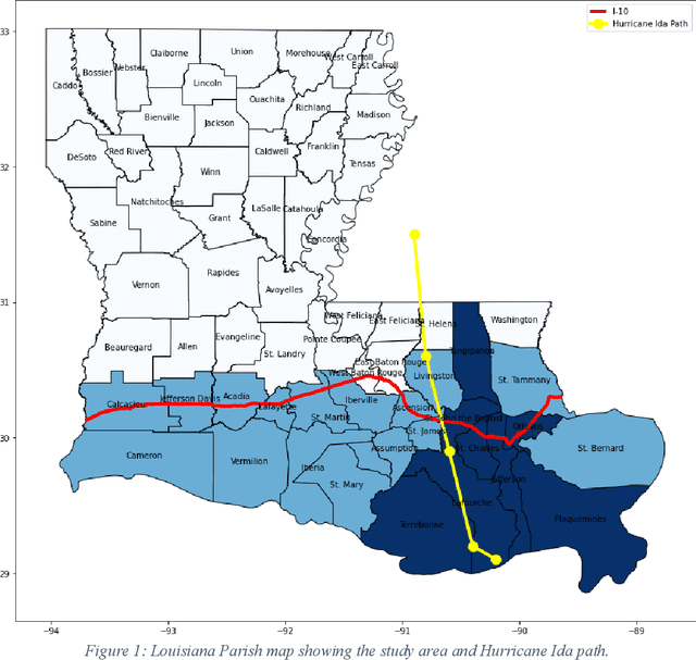
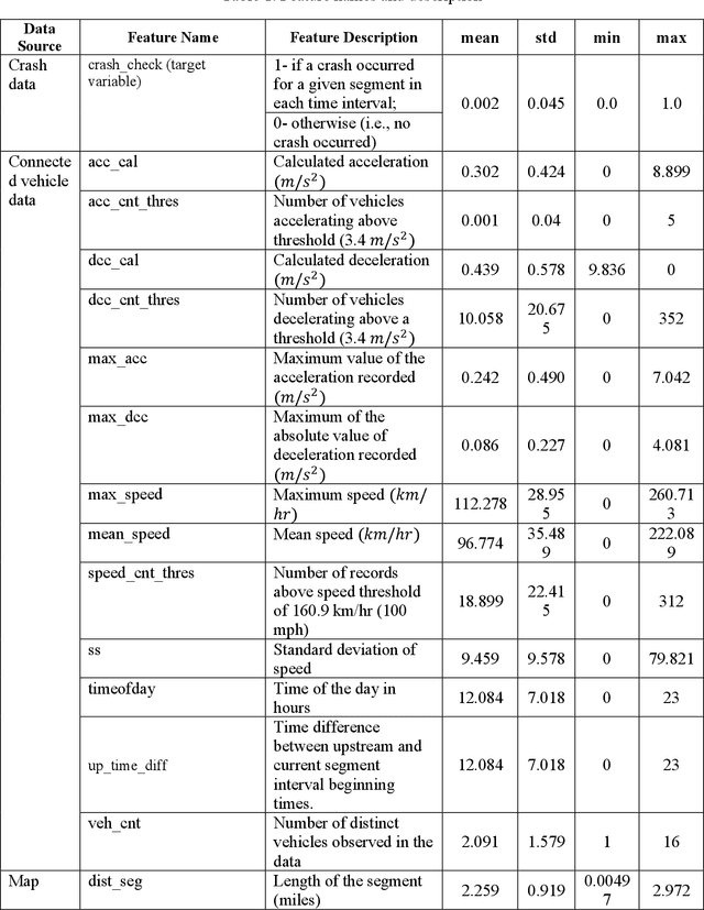
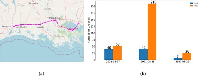
Abstract:Hurricane evacuation, ordered to save lives of people of coastal regions, generates high traffic demand with increased crash risk. To mitigate such risk, transportation agencies need to anticipate highway locations with high crash risks to deploy appropriate countermeasures. With ubiquitous sensors and communication technologies, it is now possible to retrieve micro-level vehicular data containing individual vehicle trajectory and speed information. Such high-resolution vehicle data, potentially available in real time, can be used to assess prevailing traffic safety conditions. Using vehicle speed and acceleration profiles, potential crash risks can be predicted in real time. Previous studies on real-time crash risk prediction mainly used data from infrastructure-based sensors which may not cover many road segments. In this paper, we present methods to determine potential crash risks during hurricane evacuation from an emerging alternative data source known as connected vehicle data. Such data contain vehicle location, speed, and acceleration information collected at a very high frequency (less than 30 seconds). To predict potential crash risks, we utilized a dataset collected during the evacuation period of Hurricane Ida on Interstate-10 (I-10) in the state of Louisiana. Multiple machine learning models were trained considering weather features and different traffic characteristics extracted from the connected vehicle data in 5-minute intervals. The results indicate that the Gaussian Process Boosting (GPBoost) and Extreme Gradient Boosting (XGBoost) models perform better (recall = 0.91) than other models. The real-time connected vehicle data for crash risks assessment will allow traffic managers to efficiently utilize resources to proactively take safety measures.
 Add to Chrome
 Add to Firefox
 Add to Edge