Yousef Alborzi
Automated Wheat Disease Detection using a ROS-based Autonomous Guided UAV
Jun 30, 2022


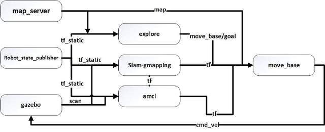
Abstract:With the increase in world population, food resources have to be modified to be more productive, resistive, and reliable. Wheat is one of the most important food resources in the world, mainly because of the variety of wheat-based products. Wheat crops are threatened by three main types of diseases which cause large amounts of annual damage in crop yield. These diseases can be eliminated by using pesticides at the right time. While the task of manually spraying pesticides is burdensome and expensive, agricultural robotics can aid farmers by increasing the speed and decreasing the amount of chemicals. In this work, a smart autonomous system has been implemented on an unmanned aerial vehicle to automate the task of monitoring wheat fields. First, an image-based deep learning approach is used to detect and classify disease-infected wheat plants. To find the most optimal method, different approaches have been studied. Because of the lack of a public wheat-disease dataset, a custom dataset has been created and labeled. Second, an efficient mapping and navigation system is presented using a simulation in the robot operating system and Gazebo environments. A 2D simultaneous localization and mapping algorithm is used for mapping the workspace autonomously with the help of a frontier-based exploration method.
 Add to Chrome
 Add to Firefox
 Add to Edge