Tatjana Dokic
Integrating Artificial Intelligence Models and Synthetic Image Data for Enhanced Asset Inspection and Defect Identification
Oct 15, 2024


Abstract:In the past utilities relied on in-field inspections to identify asset defects. Recently, utilities have started using drone-based inspections to enhance the field-inspection process. We consider a vast repository of drone images, providing a wealth of information about asset health and potential issues. However, making the collected imagery data useful for automated defect detection requires significant manual labeling effort. We propose a novel solution that combines synthetic asset defect images with manually labeled drone images. This solution has several benefits: improves performance of defect detection, reduces the number of hours spent on manual labeling, and enables the capability to generate realistic images of rare defects where not enough real-world data is available. We employ a workflow that combines 3D modeling tools such as Maya and Unreal Engine to create photorealistic 3D models and 2D renderings of defective assets and their surroundings. These synthetic images are then integrated into our training pipeline augmenting the real data. This study implements an end-to-end Artificial Intelligence solution to detect assets and asset defects from the combined imagery repository. The unique contribution of this research lies in the application of advanced computer vision models and the generation of photorealistic 3D renderings of defective assets, aiming to transform the asset inspection process. Our asset detection model has achieved an accuracy of 92 percent, we achieved a performance lift of 67 percent when introducing approximately 2,000 synthetic images of 2k resolution. In our tests, the defect detection model achieved an accuracy of 73 percent across two batches of images. Our analysis demonstrated that synthetic data can be successfully used in place of real-world manually labeled data to train defect detection model.
Prediction of Solar Radiation Based on Spatial and Temporal Embeddings for Solar Generation Forecast
Jun 17, 2022


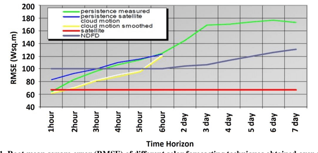
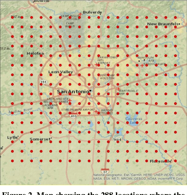
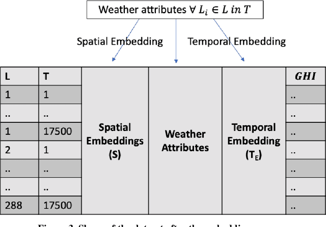
Abstract:A novel method for real-time solar generation forecast using weather data, while exploiting both spatial and temporal structural dependencies is proposed. The network observed over time is projected to a lower-dimensional representation where a variety of weather measurements are used to train a structured regression model while weather forecast is used at the inference stage. Experiments were conducted at 288 locations in the San Antonio, TX area on obtained from the National Solar Radiation Database. The model predicts solar irradiance with a good accuracy (R2 0.91 for the summer, 0.85 for the winter, and 0.89 for the global model). The best accuracy was obtained by the Random Forest Regressor. Multiple experiments were conducted to characterize influence of missing data and different time horizons providing evidence that the new algorithm is robust for data missing not only completely at random but also when the mechanism is spatial, and temporal.
 Add to Chrome
 Add to Firefox
 Add to Edge