Sanchit Singhal
CoReFusion: Contrastive Regularized Fusion for Guided Thermal Super-Resolution
Apr 24, 2023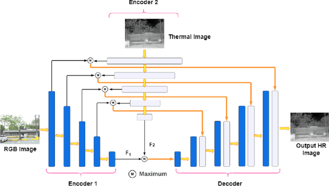

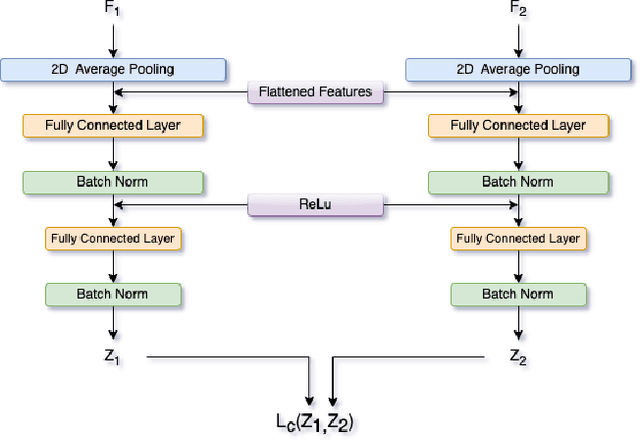
Abstract:Thermal imaging has numerous advantages over regular visible-range imaging since it performs well in low-light circumstances. Super-Resolution approaches can broaden their usefulness by replicating accurate high-resolution thermal pictures using measurements from low-cost, low-resolution thermal sensors. Because of the spectral range mismatch between the images, Guided Super-Resolution of thermal images utilizing visible range images is difficult. However, In case of failure to capture Visible Range Images can prevent the operations of applications in critical areas. We present a novel data fusion framework and regularization technique for Guided Super Resolution of Thermal images. The proposed architecture is computationally in-expensive and lightweight with the ability to maintain performance despite missing one of the modalities, i.e., high-resolution RGB image or the lower-resolution thermal image, and is designed to be robust in the presence of missing data. The proposed method presents a promising solution to the frequently occurring problem of missing modalities in a real-world scenario. Code is available at https://github.com/Kasliwal17/CoReFusion .
SSS at SemEval-2023 Task 10: Explainable Detection of Online Sexism using Majority Voted Fine-Tuned Transformers
Apr 23, 2023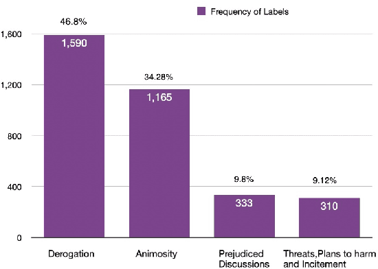
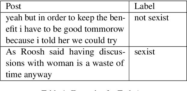
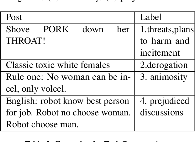
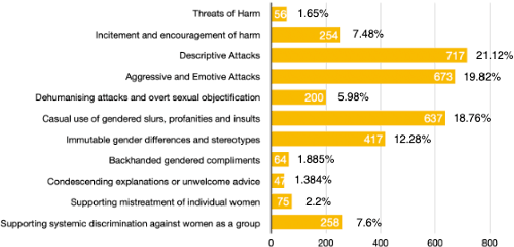
Abstract:This paper describes our submission to Task 10 at SemEval 2023-Explainable Detection of Online Sexism (EDOS), divided into three subtasks. The recent rise in social media platforms has seen an increase in disproportionate levels of sexism experienced by women on social media platforms. This has made detecting and explaining online sexist content more important than ever to make social media safer and more accessible for women. Our approach consists of experimenting and finetuning BERT-based models and using a Majority Voting ensemble model that outperforms individual baseline model scores. Our system achieves a macro F1 score of 0.8392 for Task A, 0.6092 for Task B, and 0.4319 for Task C.
Performance evaluation of deep segmentation models on Landsat-8 imagery
Nov 30, 2022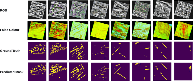

Abstract:Contrails, short for condensation trails, are line-shaped ice clouds produced by aircraft engine exhaust when they fly through cold and humid air. They generate a greenhouse effect by absorbing or directing back to Earth approximately 33% of emitted outgoing longwave radiation. They account for over half of the climate change resulting from aviation activities. Avoiding contrails and adjusting flight routes could be an inexpensive and effective way to reduce their impact. An accurate, automated, and reliable detection algorithm is required to develop and evaluate contrail avoidance strategies. Advancement in contrail detection has been severely limited due to several factors, primarily due to a lack of quality-labeled data. Recently, proposed a large human-labeled Landsat-8 contrails dataset. Each contrail is carefully labeled with various inputs in various scenes of Landsat-8 satellite imagery. In this work, we benchmark several popular segmentation models with combinations of different loss functions and encoder backbones. This work is the first to apply state-of-the-art segmentation techniques to detect contrails in low-orbit satellite imagery. Our work can also be used as an open benchmark for contrail segmentation and is publicly available.
 Add to Chrome
 Add to Firefox
 Add to Edge