Peter T. Fretwell
Using Deep Learning to Count Albatrosses from Space
Jul 03, 2019


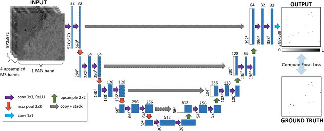
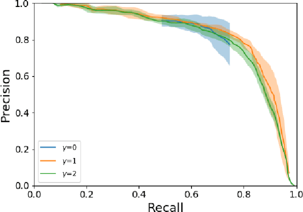
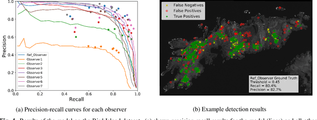
Abstract:In this paper we test the use of a deep learning approach to automatically count Wandering Albatrosses in Very High Resolution (VHR) satellite imagery. We use a dataset of manually labelled imagery provided by the British Antarctic Survey to train and develop our methods. We employ a U-Net architecture, designed for image segmentation, to simultaneously classify and localise potential albatrosses. We aid training with the use of the Focal Loss criterion, to deal with extreme class imbalance in the dataset. Initial results achieve peak precision and recall values of approximately 80%. Finally we assess the model's performance in relation to inter-observer variation, by comparing errors against an image labelled by multiple observers. We conclude model accuracy falls within the range of human counters. We hope that the methods will streamline the analysis of VHR satellite images, enabling more frequent monitoring of a species which is of high conservation concern.
 Add to Chrome
 Add to Firefox
 Add to Edge