Muhammad Amir Shafiq
A novel attention model for salient structure detection in seismic volumes
Jan 17, 2022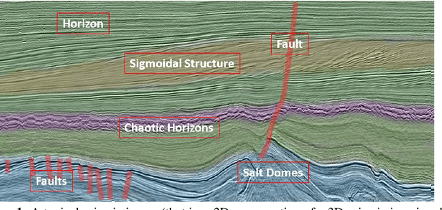

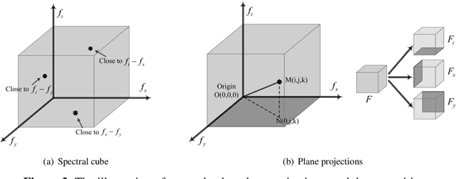
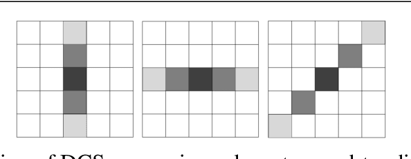
Abstract:A new approach to seismic interpretation is proposed to leverage visual perception and human visual system modeling. Specifically, a saliency detection algorithm based on a novel attention model is proposed for identifying subsurface structures within seismic data volumes. The algorithm employs 3D-FFT and a multi-dimensional spectral projection, which decomposes local spectra into three distinct components, each depicting variations along different dimensions of the data. Subsequently, a novel directional center-surround attention model is proposed to incorporate directional comparisons around each voxel for saliency detection within each projected dimension. Next, the resulting saliency maps along each dimension are combined adaptively to yield a consolidated saliency map, which highlights various structures characterized by subtle variations and relative motion with respect to their neighboring sections. A priori information about the seismic data can be either embedded into the proposed attention model in the directional comparisons, or incorporated into the algorithm by specifying a template when combining saliency maps adaptively. Experimental results on two real seismic datasets from the North Sea, Netherlands and Great South Basin, New Zealand demonstrate the effectiveness of the proposed algorithm for detecting salient seismic structures of different natures and appearances in one shot, which differs significantly from traditional seismic interpretation algorithms. The results further demonstrate that the proposed method outperforms comparable state-of-the-art saliency detection algorithms for natural images and videos, which are inadequate for seismic imaging data.
* Published in Applied Computing and Intelligence, Nov. 2021
Saliency detection for seismic applications using multi-dimensional spectral projections and directional comparisons
Jan 30, 2019
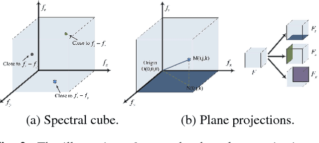

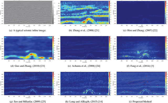
Abstract:In this paper, we propose a novel approach for saliency detection for seismic applications using 3D-FFT local spectra and multi-dimensional plane projections. We develop a projection scheme by dividing a 3D-FFT local spectrum of a data volume into three distinct components, each depicting changes along a different dimension of the data. The saliency detection results obtained using each projected component are then combined to yield a saliency map. To accommodate the directional nature of seismic data, in this work, we modify the center-surround model, proven to be biologically plausible for visual attention, to incorporate directional comparisons around each voxel in a 3D volume. Experimental results on real seismic dataset from the F3 block in Netherlands offshore in the North Sea prove that the proposed algorithm is effective, efficient, and scalable. Furthermore, a subjective comparison of the results shows that it outperforms the state-of-the-art methods for saliency detection.
SalSi: A new seismic attribute for salt dome detection
Jan 09, 2019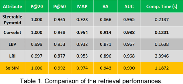
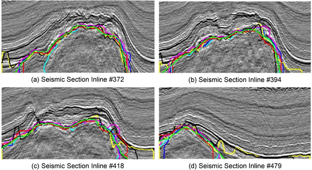
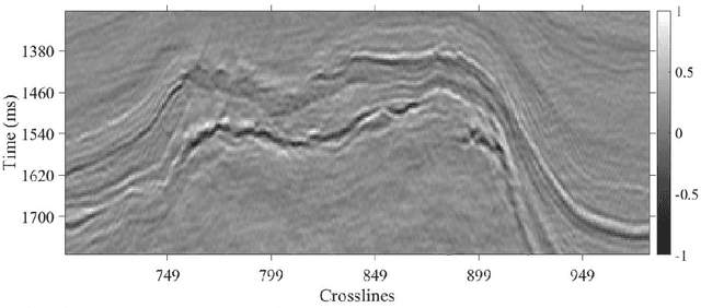
Abstract:In this paper, we propose a saliency-based attribute, SalSi, to detect salt dome bodies within seismic volumes. SalSi is based on the saliency theory and modeling of the human vision system (HVS). In this work, we aim to highlight the parts of the seismic volume that receive highest attention from the human interpreter, and based on the salient features of a seismic image, we detect the salt domes. Experimental results show the effectiveness of SalSi on the real seismic dataset acquired from the North Sea, F3 block. Subjectively, we have used the ground truth and the output of different salt dome delineation algorithms to validate the results of SalSi. For the objective evaluation of results, we have used the receiver operating characteristics (ROC) curves and area under the curves (AUC) to demonstrate SalSi is a promising and an effective attribute for seismic interpretation.
The role of visual saliency in the automation of seismic interpretation
Dec 31, 2018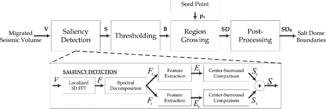


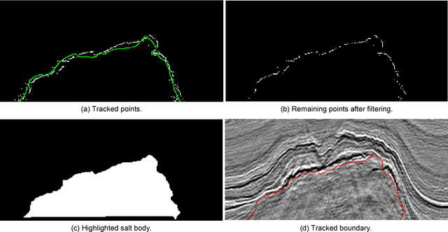
Abstract:In this paper, we propose a workflow based on SalSi for the detection and delineation of geological structures such as salt domes. SalSi is a seismic attribute designed based on the modeling of human visual system that detects the salient features and captures the spatial correlation within seismic volumes for delineating seismic structures. Using SalSi, we can not only highlight the neighboring regions of salt domes to assist a seismic interpreter but also delineate such structures using a region growing method and post-processing. The proposed delineation workflow detects the salt-dome boundary with very good precision and accuracy. Experimental results show the effectiveness of the proposed workflow on a real seismic dataset acquired from the North Sea, F3 block. For the subjective evaluation of the results of different salt-dome delineation algorithms, we have used a reference salt-dome boundary interpreted by a geophysicist. For the objective evaluation of results, we have used five different metrics based on pixels, shape, and curvedness to establish the effectiveness of the proposed workflow. The proposed workflow is not only fast but also yields better results as compared to other salt-dome delineation algorithms and shows a promising potential in seismic interpretation.
 Add to Chrome
 Add to Firefox
 Add to Edge