Mohammad Kakooei
Mapping Africa Settlements: High Resolution Urban and Rural Map by Deep Learning and Satellite Imagery
Nov 05, 2024Abstract:Accurate Land Use and Land Cover (LULC) maps are essential for understanding the drivers of sustainable development, in terms of its complex interrelationships between human activities and natural resources. However, existing LULC maps often lack precise urban and rural classifications, particularly in diverse regions like Africa. This study presents a novel construction of a high-resolution rural-urban map using deep learning techniques and satellite imagery. We developed a deep learning model based on the DeepLabV3 architecture, which was trained on satellite imagery from Landsat-8 and the ESRI LULC dataset, augmented with human settlement data from the GHS-SMOD. The model utilizes semantic segmentation to classify land into detailed categories, including urban and rural areas, at a 10-meter resolution. Our findings demonstrate that incorporating LULC along with urban and rural classifications significantly enhances the model's ability to accurately distinguish between urban, rural, and non-human settlement areas. Therefore, our maps can support more informed decision-making for policymakers, researchers, and stakeholders. We release a continent wide urban-rural map, covering the period 2016 and 2022.
Analyzing Poverty through Intra-Annual Time-Series: A Wavelet Transform Approach
Nov 05, 2024


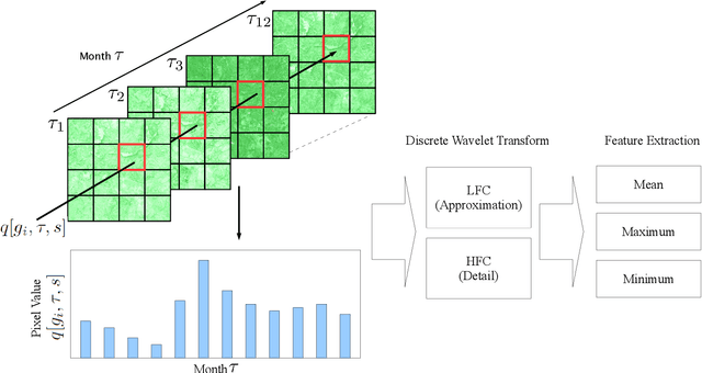
Abstract:Reducing global poverty is a key objective of the Sustainable Development Goals (SDGs). Achieving this requires high-frequency, granular data to capture neighborhood-level changes, particularly in data scarce regions such as low- and middle-income countries. To fill in the data gaps, recent computer vision methods combining machine learning (ML) with earth observation (EO) data to improve poverty estimation. However, while much progress have been made, they often omit intra-annual variations, which are crucial for estimating poverty in agriculturally dependent countries. We explored the impact of integrating intra-annual NDVI information with annual multi-spectral data on model accuracy. To evaluate our method, we created a simulated dataset using Landsat imagery and nighttime light data to evaluate EO-ML methods that use intra-annual EO data. Additionally, we evaluated our method against the Demographic and Health Survey (DHS) dataset across Africa. Our results indicate that integrating specific NDVI-derived features with multi-spectral data provides valuable insights for poverty analysis, emphasizing the importance of retaining intra-annual information.
 Add to Chrome
 Add to Firefox
 Add to Edge