Marta B. Lopes
Satellite-based feature extraction and multivariate time-series prediction of biotoxin contamination in shellfish
Nov 25, 2023


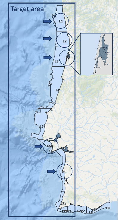
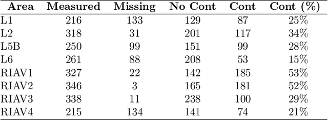
Abstract:Shellfish production constitutes an important sector for the economy of many Portuguese coastal regions, yet the challenge of shellfish biotoxin contamination poses both public health concerns and significant economic risks. Thus, predicting shellfish contamination levels holds great potential for enhancing production management and safeguarding public health. In our study, we utilize a dataset with years of Sentinel-3 satellite imagery for marine surveillance, along with shellfish biotoxin contamination data from various production areas along Portugal's western coastline, collected by Portuguese official control. Our goal is to evaluate the integration of satellite data in forecasting models for predicting toxin concentrations in shellfish given forecasting horizons up to four weeks, which implies extracting a small set of useful features and assessing their impact on the predictive models. We framed this challenge as a time-series forecasting problem, leveraging historical contamination levels and satellite images for designated areas. While contamination measurements occurred weekly, satellite images were accessible multiple times per week. Unsupervised feature extraction was performed using autoencoders able to handle non-valid pixels caused by factors like cloud cover, land, or anomalies. Finally, several Artificial Neural Networks models were applied to compare univariate (contamination only) and multivariate (contamination and satellite data) time-series forecasting. Our findings show that incorporating these features enhances predictions, especially beyond one week in lagoon production areas (RIAV) and for the 1-week and 2-week horizons in the L5B area (oceanic). The methodology shows the feasibility of integrating information from a high-dimensional data source like remote sensing without compromising the model's predictive ability.
 Add to Chrome
 Add to Firefox
 Add to Edge