Maria Falquez
Predicting Barge Presence and Quantity on Inland Waterways using Vessel Tracking Data: A Machine Learning Approach
Dec 31, 2024


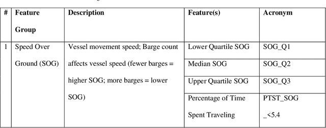
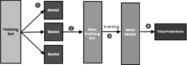
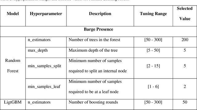
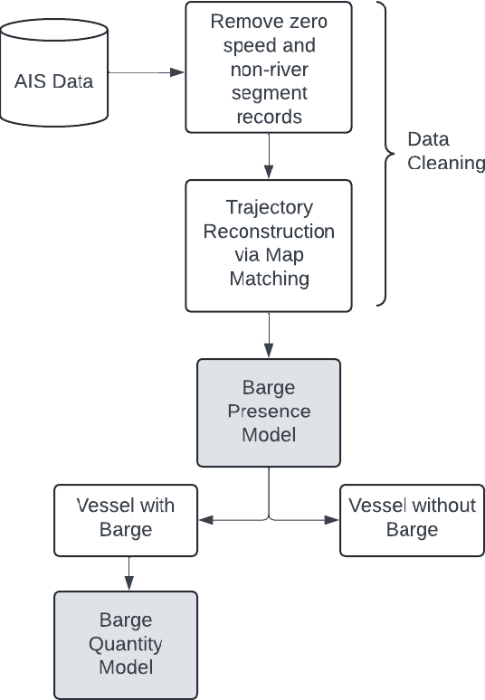
Abstract:This study presents a machine learning approach to predict the number of barges transported by vessels on inland waterways using tracking data from the Automatic Identification System (AIS). While AIS tracks the location of tug and tow vessels, it does not monitor the presence or number of barges transported by those vessels. Understanding the number and types of barges conveyed along river segments, between ports, and at ports is crucial for estimating the quantities of freight transported on the nation's waterways. This insight is also valuable for waterway management and infrastructure operations impacting areas such as targeted dredging operations, and data-driven resource allocation. Labeled sample data was generated using observations from traffic cameras located along key river segments and matched to AIS data records. A sample of 164 vessels representing up to 42 barge convoys per vessel was used for model development. The methodology involved first predicting barge presence and then predicting barge quantity. Features derived from the AIS data included speed measures, vessel characteristics, turning measures, and interaction terms. For predicting barge presence, the AdaBoost model achieved an F1 score of 0.932. For predicting barge quantity, the Random Forest combined with an AdaBoost ensemble model achieved an F1 score of 0.886. Bayesian optimization was used for hyperparameter tuning. By advancing predictive modeling for inland waterways, this study offers valuable insights for transportation planners and organizations, which require detailed knowledge of traffic volumes, including the flow of commodities, their destinations, and the tonnage moving in and out of ports.
Traffic Cameras to detect inland waterway barge traffic: An Application of machine learning
Jan 05, 2024Abstract:Inland waterways are critical for freight movement, but limited means exist for monitoring their performance and usage by freight-carrying vessels, e.g., barges. While methods to track vessels, e.g., tug and tow boats, are publicly available through Automatic Identification Systems (AIS), ways to track freight tonnages and commodity flows carried on barges along these critical marine highways are non-existent, especially in real-time settings. This paper develops a method to detect barge traffic on inland waterways using existing traffic cameras with opportune viewing angles. Deep learning models, specifically, You Only Look Once (YOLO), Single Shot MultiBox Detector (SSD), and EfficientDet are employed. The model detects the presence of vessels and/or barges from video and performs a classification (no vessel or barge, vessel without barge, vessel with barge, and barge). A dataset of 331 annotated images was collected from five existing traffic cameras along the Mississippi and Ohio Rivers for model development. YOLOv8 achieves an F1-score of 96%, outperforming YOLOv5, SSD, and EfficientDet models with 86%, 79%, and 77% respectively. Sensitivity analysis was carried out regarding weather conditions (fog and rain) and location (Mississippi and Ohio rivers). A background subtraction technique was used to normalize video images across the various locations for the location sensitivity analysis. This model can be used to detect the presence of barges along river segments, which can be used for anonymous bulk commodity tracking and monitoring. Such data is valuable for long-range transportation planning efforts carried out by public transportation agencies, in addition to operational and maintenance planning conducted by federal agencies such as the US Army Corp of Engineers.
 Add to Chrome
 Add to Firefox
 Add to Edge