Gaëtan Garcia
Longitudinal Dynamics Model Identification of an Electric Car Based on Real Response Approximation
Mar 17, 2020


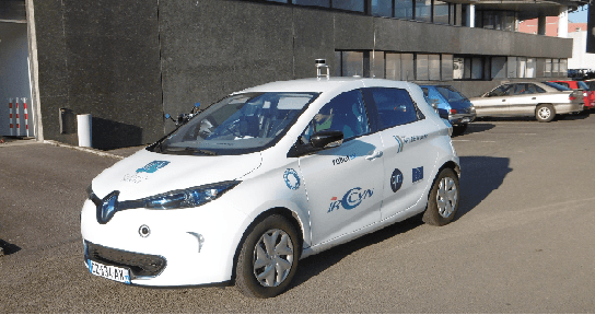
Abstract:Obtaining a realistic and accurate model of the longitudinal dynamics is key for a good speed control of a self-driving car. It is also useful to simulate the longitudinal behavior of the vehicle with high fidelity. In this paper, a straightforward and generic method for obtaining the friction, braking and propulsion forces as a function of speed, throttle input and brake input is proposed. Experimental data is recorded during tests over the full speed range to estimate the forces, to which the corresponding curves are adjusted. A simple and direct balance of forces in the direction tangent to the ground is used to obtain an estimation of the real forces involved. Then a model composed of approximate spline curves that fit the results is proposed. Using splines to model the dynamic response has the advantage of being quick and accurate, avoiding the complexity of parameter identification and tuning of non-linear responses embedding the internal functionalities of the car, like ABS or regenerative brake. This methodology has been applied to LS2N's electric Renault Zoe but can be applied to any other electric car. As shown in the experimental section, a comparison between the estimated acceleration of the car using the model and the real one over a wide range of speeds along a trip of about $10km/h$ reveals only $0.35m/s^2$ of error standard deviation in a range of $\pm{2}m/s^2$ which is very encouraging.
An Experimental Evaluation of Robustness and Precision for Long-term LiDAR-based Localization in Highly Changing Environments
Mar 17, 2020


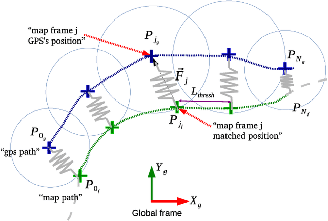
Abstract:One of the hardest challenges to face in the development of a non GPS-based localization system for autonomous vehicles is the changes of the environment. LiDAR-based systems typically try to match the last measurements obtained with a previously recorded map of the area. If the existing map is not updated along time, there is a good chance that the measures will not match the environment well enough, causing the vehicle to lose track of its location. In this paper, we present and analyze experimental results regarding the robustness and precision of a map-matching based localization system over a certain period of time in the following three cases: (1) without any update of the initial map, (2) updating the map as the vehicle moves and (3) with map updates that take into account surrounding structures labeled as "fixed" which are treated differently. The environment of the tests is a busy parking area, which ensures drastic changes from one day to the next. The precision is obtained by comparing the positions computed using the map with the ones provided by a Real-Time Kinematic GPS system. The experimental results reveal a positioning error of about 6cm which remains stable even after 23 days when using fixed structures on the working area.
 Add to Chrome
 Add to Firefox
 Add to Edge