Dan Hammer
Satellite Monitoring of Terrestrial Plastic Waste
Mar 24, 2022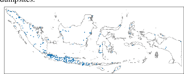
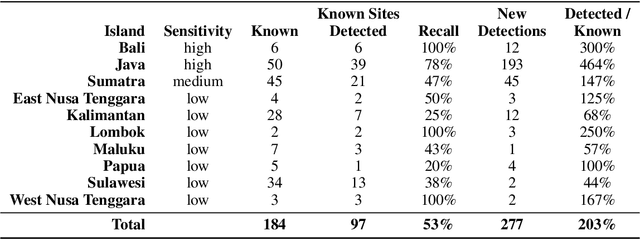
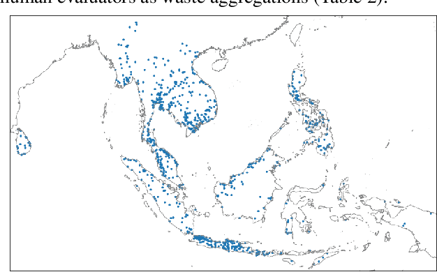
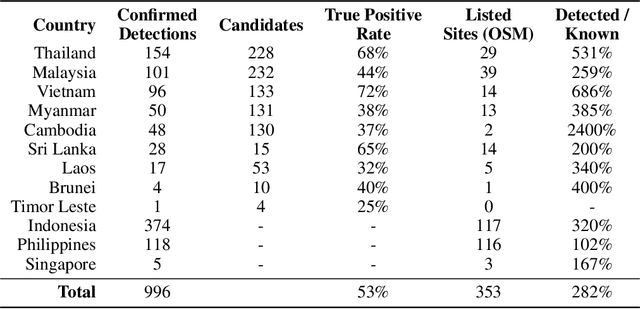
Abstract:Plastic waste is a significant environmental pollutant that is difficult to monitor. We created a system of neural networks to analyze spectral, spatial, and temporal components of Sentinel-2 satellite data to identify terrestrial aggregations of waste. The system works at continental scale. We evaluated performance in Indonesia and detected 374 waste aggregations, more than double the number of sites found in public databases. The same system deployed across twelve countries in Southeast Asia identifies 996 subsequently confirmed waste sites. For each detected site, we algorithmically monitor waste site footprints through time and cross-reference other datasets to generate physical and social metadata. 19% of detected waste sites are located within 200 m of a waterway. Numerous sites sit directly on riverbanks, with high risk of ocean leakage.
Detecting Human Interventions on the Landscape: KAZE Features, Poisson Point Processes, and a Construction Dataset
Mar 29, 2017
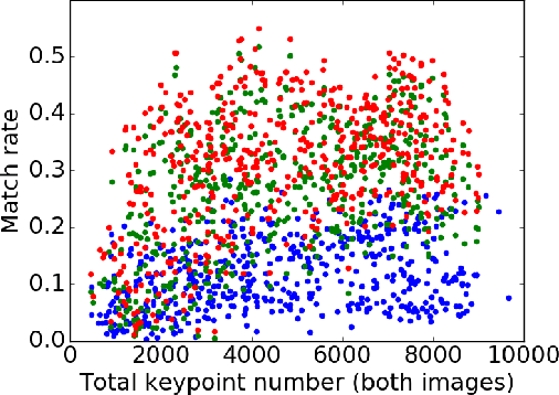

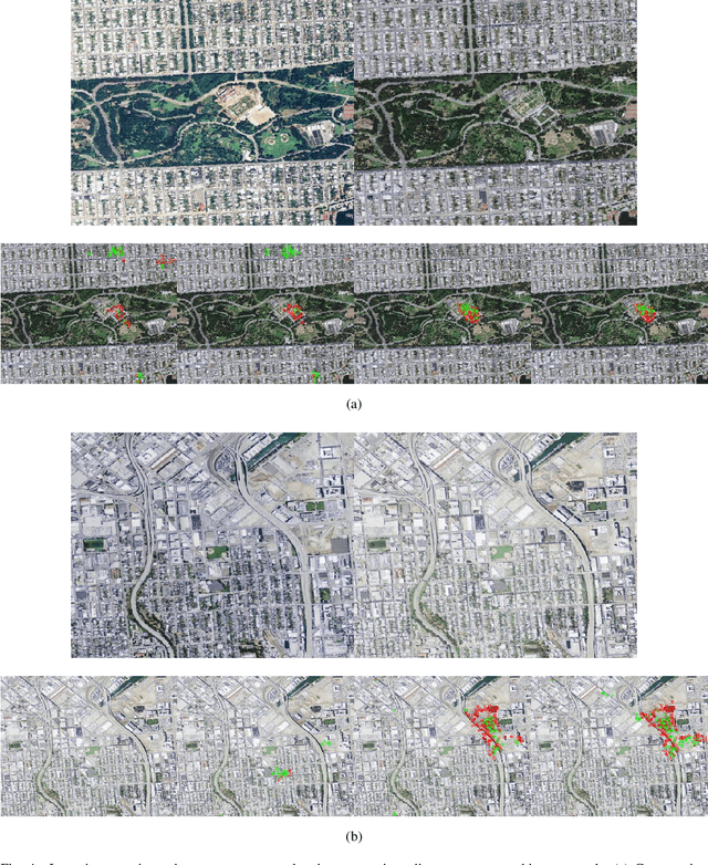
Abstract:We present an algorithm capable of identifying a wide variety of human-induced change on the surface of the planet by analyzing matches between local features in time-sequenced remote sensing imagery. We evaluate feature sets, match protocols, and the statistical modeling of feature matches. With application of KAZE features, k-nearest-neighbor descriptor matching, and geometric proximity and bi-directional match consistency checks, average match rates increase more than two-fold over the previous standard. In testing our platform, we developed a small, labeled benchmark dataset expressing large-scale residential, industrial, and civic construction, along with null instances, in California between the years 2010 and 2012. On the benchmark set, our algorithm makes precise, accurate change proposals on two-thirds of scenes. Further, the detection threshold can be tuned so that all or almost all proposed detections are true positives.
 Add to Chrome
 Add to Firefox
 Add to Edge