D. Bull
Stratospheric aerosol source inversion: Noise, variability, and uncertainty quantification
Sep 10, 2024Abstract:Stratospheric aerosols play an important role in the earth system and can affect the climate on timescales of months to years. However, estimating the characteristics of partially observed aerosol injections, such as those from volcanic eruptions, is fraught with uncertainties. This article presents a framework for stratospheric aerosol source inversion which accounts for background aerosol noise and earth system internal variability via a Bayesian approximation error approach. We leverage specially designed earth system model simulations using the Energy Exascale Earth System Model (E3SM). A comprehensive framework for data generation, data processing, dimension reduction, operator learning, and Bayesian inversion is presented where each component of the framework is designed to address particular challenges in stratospheric modeling on the global scale. We present numerical results using synthesized observational data to rigorously assess the ability of our approach to estimate aerosol sources and associate uncertainty with those estimates.
The application of Convolutional Neural Networks to Detect Slow, Sustained Deformation in InSAR Timeseries
Sep 05, 2019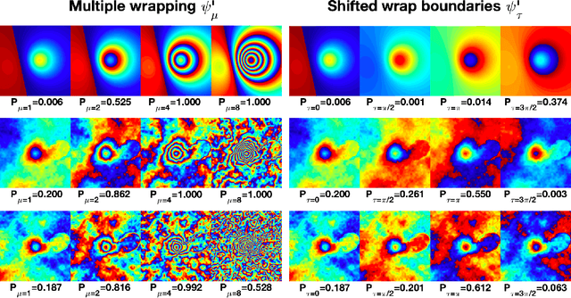
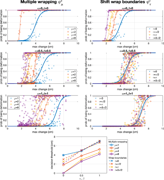
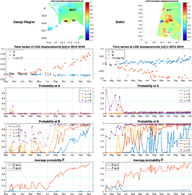
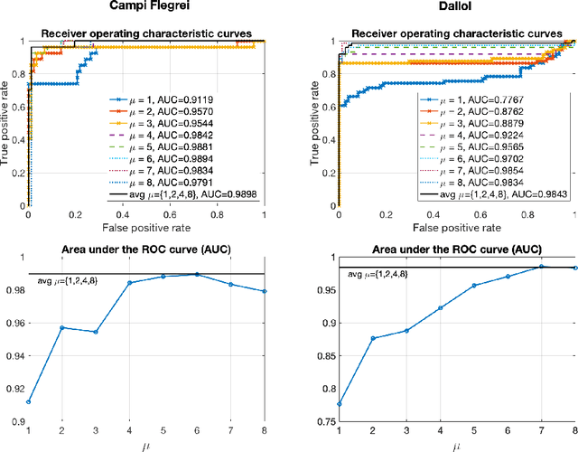
Abstract:Automated systems for detecting deformation in satellite InSAR imagery could be used to develop a global monitoring system for volcanic and urban environments. Here we explore the limits of a CNN for detecting slow, sustained deformations in wrapped interferograms. Using synthetic data, we estimate a detection threshold of 3.9cm for deformation signals alone, and 6.3cm when atmospheric artefacts are considered. Over-wrapping reduces this to 1.8cm and 5.0cm respectively as more fringes are generated without altering SNR. We test the approach on timeseries of cumulative deformation from Campi Flegrei and Dallol, where over-wrapping improves classication performance by up to 15%. We propose a mean-filtering method for combining results of different wrap parameters to flag deformation. At Campi Flegrei, deformation of 8.5cm/yr was detected after 60days and at Dallol, deformation of 3.5cm/yr was detected after 310 days. This corresponds to cumulative displacements of 3 cm and 4 cm consistent with estimates based on synthetic data.
Detecting Volcano Deformation in InSAR using Deep learning
Jan 21, 2018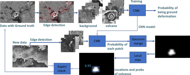
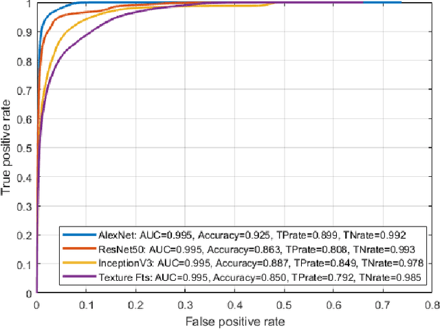
Abstract:Globally 800 million people live within 100 km of a volcano and currently 1500 volcanoes are considered active, but half of these have no ground-based monitoring. Alternatively, satellite radar (InSAR) can be employed to observe volcanic ground deformation, which has shown a significant statistical link to eruptions. Modern satellites provide large coverage with high resolution signals, leading to huge amounts of data. The explosion in data has brought major challenges associated with timely dissemination of information and distinguishing volcano deformation patterns from noise, which currently relies on manual inspection. Moreover, volcano observatories still lack expertise to exploit satellite datasets, particularly in developing countries. This paper presents a novel approach to detect volcanic ground deformation automatically from wrapped-phase InSAR images. Convolutional neural networks (CNN) are employed to detect unusual patterns within the radar data.
 Add to Chrome
 Add to Firefox
 Add to Edge